


Fire Weather Watch Issued: What It Means, Why It’s Being Posted Earlier, and What Happens Next if Conditions Worsen
A fire weather watch is an early alert that the atmosphere may soon line up in a way that makes wildfires easier to start and much harder to stop. It is not a guarantee that a major fire will ignite, but it is a signal that the risk environment is shifting fast enough that fire agencies and the public should plan for rapid changes over the next few days.
In plain terms: a watch means the ingredients for dangerous fire behavior could come together soon, often within about one to three days, depending on local criteria. If forecasts trend more certain, the watch can be upgraded to a warning.
What a Fire Weather Watch actually signals
A fire weather watch is typically issued when forecasters see a credible chance that critical wildfire-spread conditions will develop. Those conditions usually involve a combination of:
-
Very low relative humidity, which dries fine fuels like grass and brush
-
Strong, sustained winds or powerful gusts that can push flames quickly and loft embers
-
Warm temperatures that accelerate drying
-
Dry vegetation and soils, meaning there is plenty of fuel ready to burn
Local thresholds vary because landscapes vary. A windy day in one region might be routine, while the same wind paired with low humidity and dormant grass in another region can be a setup for fast-moving fires.
Fire Weather Watch vs. a warning: why the distinction matters
The watch is the heads-up phase. It is meant to give fire managers time to stage resources, adjust staffing, and coordinate with local officials. The warning stage is closer to go time, used when critical conditions are expected soon or already happening.
Think of it as escalating confidence:
-
Watch: conditions could develop in the near future
-
Warning: conditions are imminent or occurring
This matters for the public because a watch is often the best window to reduce risk without scrambling. Once a warning is posted, it can be too late for safer tasks like debris burning, equipment work in dry grass, or outdoor activities that create sparks.
Behind the headline: why watches are showing up more often
Fire weather watches reflect more than day-to-day weather. They also reflect the state of fuels and the calendar.
Incentives and pressures are converging:
-
Fire agencies want earlier notice to pre-position crews and aircraft before conditions peak.
-
Utilities face reputational and financial exposure if wind-driven fires threaten power lines and communities.
-
Local governments weigh burn bans and event restrictions against public patience and economic activity.
-
Residents often underestimate how quickly a small ignition can become a moving fire front in wind.
The stakeholder map is broad. Homeowners in grassland edges, rural communities, and even suburban corridors near open space bear direct risk. But the ripple effects extend to highways, freight movement, air quality, schools, and healthcare systems if smoke spreads.
What’s still missing when a watch is posted
A watch is about potential, which means key pieces are not locked in yet. The biggest unknowns usually include:
-
Exact wind timing and peak gust corridors
-
How low humidity will drop during the hottest part of the day
-
Whether fuels will be critically dry in the watch area or just marginal
-
Whether any triggering event occurs, such as a downed line, vehicle fire, unattended campfire, or machinery spark
A watch can also be canceled if forecasts trend toward cooler temperatures, higher humidity, lighter winds, or moisture that dampens fuels. That is why it should be treated as a planning signal, not a certainty statement.
What happens next: realistic scenarios and the triggers
Here are common next steps that follow a fire weather watch, with the trigger that usually drives each outcome:
-
Watch is upgraded to a warning
Trigger: Forecast confidence increases that wind and humidity thresholds will be met. -
Watch is extended or expanded
Trigger: The dry and windy pattern lasts longer or spreads into adjacent areas. -
Watch is canceled
Trigger: A shift in weather brings higher humidity, lighter winds, or precipitation. -
Local restrictions tighten
Trigger: Agencies see near-term ignition risk rising and move to limit burning or high-spark activities. -
A fire starts during the watch window
Trigger: Human-caused ignition during peak wind and low humidity, often in grass or brush.
Why it matters: practical risk reduction that actually works
When a fire weather watch is posted, the most effective actions are simple and immediate:
-
Avoid any outdoor burning and postpone any activity that can throw sparks
-
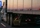
Secure trailer chains, check that they do not drag
-
Keep vehicles off dry grass and avoid idling in brush
-
Clear leaves and debris from around homes, fences, and outbuildings
-
Have water hoses, extinguishers, and an evacuation plan ready, especially in the wildland edge
The point of a fire weather watch is time. It is an early warning that the atmosphere may soon favor fast spread and difficult suppression. Using that time to remove ignition sources and reduce exposure can be the difference between a routine windy day and a damaging wildfire event.