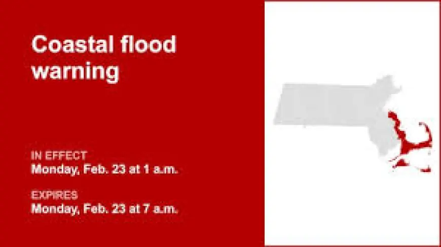
Coastal Flood Warning Upgraded for Four Massachusetts Counties; Separate Watch Covers Three More

The National Weather Service has issued a coastal flood warning for parts of Massachusetts, replacing an earlier watch and prompting targeted guidance for shoreline communities. The coastal flood warning and an overlapping coastal flood watch matter now because officials expect measurable inundation and brief windows of impassable coastal roads that could disrupt travel and ferry access.
Coastal Flood Warning: development details
The National Weather Service issued the coastal flood warning at 2: 03 p. m. on Saturday. The warning is valid Monday between 1 a. m. and 7 a. m. for four counties: Plymouth, Barnstable, Dukes and Nantucket. For those counties the weather service forecasts two to three feet of inundation above ground level in low-lying areas near shorelines and tidal waterways, with the guidance translating that to roughly 4. 5 to 13. 5 feet Mean Lower Low Water.
Separately, a coastal flood watch was released for Essex, Suffolk and Norfolk counties on the same Saturday at 2: 03 p. m., and remains in effect from Monday 1 a. m. until Tuesday 7 a. m. For that three-county watch, the weather service put possible inundation at one to two feet above ground level (roughly 3. 5 to 12. 9 feet Mean Lower Low Water).
The weather service explicitly replaced the prior coastal flood watch for Plymouth, Barnstable, Dukes and Nantucket with the upgraded warning and directed attention to updates issued by NWS Boston/Norton MA. Officials advised taking steps to protect flood-prone property and warned against driving through water whose depth is unknown.
Context and escalation
The sequence moved from watch to warning for the four counties when conditions were assessed as more likely to produce damaging coastal inundation in a concentrated time window. A flood watch signals that conditions are favorable for flooding, while a flood warning indicates flooding is imminent or already occurring; the upgrade reflects that elevated risk level for the specified Monday morning hours.
What makes this notable is the overlap of distinct advisories across two geographic groupings—an upgraded Coastal Flood Warning for island and southern coastal counties and a longer-duration coastal flood watch for parts of the northeastern coast—meaning different communities face different expected water depths and exposure timelines.
Immediate impact
The warning lists specific locations where roads and access points are expected to be affected. On Nantucket, many roads near Nantucket Harbor can become impassable with one to two feet of water, affecting access to ferry terminals and naming Easy Street, South Beach Street, Easton Street, Walsh Street, Willard Street and Straight Wharf. In Dukes and Vineyard areas, the Chappy Ferry Dock and Dock Street near Edgartown Harbor may see one to three feet of flooding; in Vineyard Haven, Five Corners, Beach Road and Water Street could become impassable. Oak Bluffs faces possible impacts on East Chop Drive, the section of Lake Avenue near Oak Bluffs Harbor and Sea View Avenue, with the weather service warning that debris may wash onto roadways.
The practical effect will be closures or limited access at key ferry terminals and coastal thoroughfares in the affected counties during the valid period. Emergency guidance stresses that even shallow water can be dangerous—just six inches of moving water can knock a person off their feet, and 12 inches of rushing water can carry away most vehicles—underscoring the instruction to avoid walking or driving through floodwaters.
Forward outlook
The immediate milestone is the Monday 1 a. m. start of the warning window for Plymouth, Barnstable, Dukes and Nantucket counties and the beginning of the coastal watch window for Essex, Suffolk and Norfolk counties; the warning expires at 7 a. m. Monday and the watch continues through 7 a. m. Tuesday for the three northeastern counties. The National Weather Service has asked residents to monitor updates from NWS Boston/Norton MA and to take actions now to protect flood-prone property.
Residents in low-lying or flood-prone areas are advised to move to higher ground if flooding begins and to heed local evacuation orders if issued. The guidance also recommends securing utilities and avoiding basements or submerged rooms to reduce electrical hazards. With specific streets and ferry access points named in the warning, the immediate scheduling impact is clear: travelers and local officials must plan for restricted access during the stated hours and prepare for possible debris and roadway inundation.


