


Wind Advisory in Effect Across Multiple Michigan Regions Through Friday; Gusts Up to 45 mph Expected
The National Weather Service has issued a wind advisory for broad swaths of Michigan for Friday, and residents are being urged to secure loose objects and take care on roads as gusts up to 45 mph are expected. The wind advisory matters because forecasters say the strongest gusts are likely in the afternoon and conditions could produce tree damage and localized outages.
Wind Advisory: What happened and what’s new
Two weather advisories outline overlapping but not identical areas and start times for Friday. One advisory takes effect at 7 a. m. and remains in place until 9 p. m., noting southwest winds of 15 to 30 mph with gusts up to 45 mph. That advisory lists 12 counties in southwest and south central Michigan, and names major cities within the affected area, including Grand Rapids, Lansing, Kalamazoo, Battle Creek, Jackson, Holland and others.
A separate advisory covering Southeast Michigan is in effect from 10 a. m. to 9 p. m. and calls for southwest winds of 15 to 25 mph, gusting up to 45 mph. That advisory lists Genesee, Lapeer, Lenawee, Livingston, Macomb, Monroe, Oakland, Shiawassee, Washtenaw, and Wayne Counties.
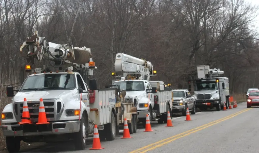
Both advisories warn that gusty winds will blow around unsecured objects, could bring down tree limbs and may result in a few power outages. Forecasters note winds will ramp up through the morning with the strongest gusts most likely during the afternoon hours. The Southeast advisory additionally notes that high winds will usher in cold and wet weather for the weekend.
Behind the headline
The immediate impetus for the wind advisory is the forecasted increase in southwest winds across multiple parts of the state during Friday, with both advisories flagging gusts as high as 45 mph. The primary practical concerns named in the advisories are damage to unsecured property, the potential for downed limbs and isolated power outages, and hazardous driving conditions for high-profile vehicles. Stakeholders who face direct exposure include local residents, drivers—especially operators of tall or light vehicles—and utility providers who may need to respond to outages.
Why this matters now: the advisories emphasize a narrow window of elevated risk that builds through the morning and peaks in the afternoon, creating a concentrated period for preparedness and response.
What we still don’t know
- Exactly which specific neighborhoods or streets will experience the strongest gusts beyond the county lists.
- The expected number or scale of power outages beyond the advisory’s estimate that a "few" may occur.
- Any municipal or utility operational changes, such as pre-positioning crews or emergency declarations, tied to the advisories.
- The precise timing and duration of the peak gusts at local observation points beyond the general afternoon timeframe.
What happens next
- Localized property and tree damage: If gusts reach the forecasted 45 mph, unsecured outdoor items and weak branches could be displaced or downed, prompting clean-up and potential minor property repairs.
- Isolated power outages: A small number of outages could occur where limbs or debris make contact with lines; utility crews would likely respond as conditions allow.
- Travel disruptions for high-profile vehicles: Drivers of tall trailers, vans, and buses may face difficult driving conditions during the afternoon peak and could choose to delay travel or seek alternate routes.
- Weekend weather shift: In the areas covered by the Southeast advisory, the strong winds are expected to precede cold and wet conditions for the weekend, which could extend impacts into subsequent days.
- Minimal impacts in some areas: Where winds remain at the lower end of the forecast range, communities may see only minor inconvenience and little or no damage.
Why it matters
Near-term effects are primarily practical: residents should secure loose items and be prepared for short-term service interruptions; drivers should exercise extra caution, particularly those operating high-profile vehicles during the advised hours. For emergency managers and utilities, the advisories provide a defined window to focus readiness and response resources. In the coming hours, the ramp-up through the morning into an afternoon peak concentrates risk into a period when people are commuting and businesses are operating, elevating the importance of timely attention to the advisory guidance.