


NYC cold weather: Wind Advisory fades, Extreme Cold Warning ends, but dangerous wind chills linger
New York City is coming out of one of the harshest cold blasts of the winter, but the risk hasn’t fully passed. The city’s Extreme Cold Warning has ended, while a Wind Advisory and a continuing cold-weather headline keep the focus on dangerous wind chills into Monday morning. Overnight lows have dropped into the single digits, and even modest wind is enough to push “feels like” temperatures below zero—conditions that can turn routine time outdoors into a frostbite risk.
Where conditions stand right now in NYC
As of late Sunday night into early Monday, skies are clear and the air is very cold. The key driver is not snow or ice falling from the sky, but a deep, dry Arctic air mass sitting over the region. With little cloud cover, temperatures fall quickly after sunset. Add wind and it becomes a health hazard for anyone outdoors without proper gear—especially people waiting on platforms, walking across bridges, or working overnight.
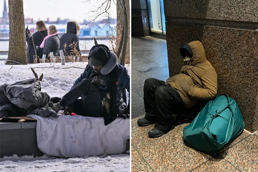
City agencies have urged residents to use warming centers and to check on older neighbors and anyone without reliable heat, as the cold can be dangerous even without a winter storm.
Wind Advisory: what it means and why it matters
The Wind Advisory posted for parts of the city and nearby areas has highlighted northwest winds around 20–25 mph with gusts up to 50 mph. Even where the strongest gusts don’t materialize, winds in the teens and 20s can still make conditions feel dramatically colder than the thermometer reading.
High gusts also create secondary problems: falling branches, difficult driving for high-profile vehicles on exposed roadways, and added strain on already stressed heating and electrical systems—especially in older buildings or areas with vulnerable underground infrastructure.
Extreme Cold Warning ended, but wind chill risk continues
The city’s Extreme Cold Warning covered the most dangerous portion of the outbreak and ran from 10:00 a.m. ET Saturday, Feb. 7 through 1:00 p.m. ET Sunday, Feb. 8. That warning period is over, but a broader cold-weather alert remains in effect that emphasizes very cold wind chills and exposure risk.
In practical terms, the difference between a warning and an advisory is less important to most residents than the outcome: if you’re outside for long stretches—especially late at night and early morning—skin exposure can become risky quickly. Wind chills near or below zero can cause frostbite on exposed skin in a relatively short time, and hypothermia becomes a concern when people can’t get warm or dry.
The week ahead: slow warmup, then winter stays close
The good news is that a gradual warmup is expected after the coldest overnight period. Temperatures climb into the 30s Monday and approach the upper 30s to low 40s by midweek. That’s still winter, but it’s a meaningful change from single-digit lows.
Here’s the near-term temperature trend for the city:
| Day (ET) | Forecast | High | Low |
|---|---|---|---|
| Sun, Feb. 8 | Cold, clear | 24°F | 6°F |
| Mon, Feb. 9 | Some sun, less brutal | 33°F | 22°F |
| Tue, Feb. 10 | Mostly cloudy | 37°F | 33°F |
| Wed, Feb. 11 | Partly sunny, breezy | 41°F | 31°F |
Even with a warmup, night refreezes remain possible later in the week when lows slip back into the 20s. That can create slick patches from melted snow piles, dripping gutters, and damp corners that never see sun.
Polar vortex talk: what it does and doesn’t mean
“Polar vortex” has become a catch-all phrase during outbreaks like this, but the useful takeaway is straightforward: a lobe of Arctic air has pushed south, allowing unusually cold air to spill into the Northeast. That doesn’t mean the vortex itself has moved to New York City; it means the larger atmospheric pattern has opened the door for repeated cold shots.
Forecast guidance points to a moderation as the jet stream configuration relaxes, which matches the city’s midweek rebound into the 40s. That said, winter patterns can reload quickly. A warming trend does not guarantee the rest of February stays mild—it just means this particular surge loosens its grip.
Weather radar map: why it looks “quiet” during a dangerous event
If you pull up a radar map during this cold snap, it may look uneventful—because radar mainly shows precipitation, not temperature. Clear radar does not mean safe conditions. In outbreaks like this, the main hazards are:
-
exposure to subzero wind chills
-
spotty black ice from refreeze
-
wind-related travel issues
Radar becomes more useful if a clipper system or lake-effect bands are nearby, but for a dry Arctic outbreak, conditions can be severe even when radar is essentially blank.
What New Yorkers should prioritize overnight
If you need to be outside late Sunday night or early Monday, the priorities are simple: cover hands and ears, limit exposure time, and take warming breaks indoors. If you’re driving, watch for isolated slick spots near curbs and shaded streets, and keep an eye on gusty conditions on bridges and open expressways.
Sources consulted: National Weather Service, NYC Emergency Management, NOAA Weather Prediction Center, CBS New York