


High Wind Warning and Extreme Cold Warning Expand as Polar Vortex Forecast Drives Dangerous Wind Chills Across the Eastern U.S.
A fast-moving Arctic surge is bringing a volatile mix of damaging wind and bitter cold to parts of the Eastern United States on Saturday, February 7, 2026, prompting a growing patchwork of High Wind Warnings, Wind Advisories, and Extreme Cold Warnings. Forecasters are flagging wind chills dipping well below zero in multiple areas, with the worst conditions expected late Saturday into early Sunday in U.S. Eastern Time.
The setup has the signature of a polar vortex-driven pattern: a lobe of very cold air sliding south while a strong pressure gradient fuels gusty northwest winds behind the front. The result is a double threat that hits hardest where people underestimate it: exposed skin, unprotected pipes, and trees and power lines stressed by wind.
What the warnings mean and why they’re showing up together
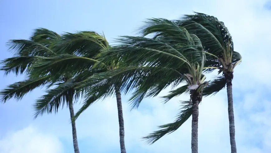
A High Wind Warning is about wind strong enough to cause damage such as downed branches, sporadic power outages, and hazardous travel for high-profile vehicles. An Extreme Cold Warning is about wind chill values that can cause frostbite quickly and become dangerous for anyone without adequate shelter.
These alerts are appearing together because wind is acting like a force multiplier. Even if the thermometer reads in the teens, strong gusts can push perceived temperatures down into dangerous territory, especially at night when radiational cooling stacks on top of the Arctic air mass.
Behind the headline: the polar vortex forecast and the “pressure-gradient punch”
This weekend’s pattern is being driven by two overlapping dynamics:
First, a deep reservoir of cold air is spilling south out of Canada. Second, a strong storm track offshore and a building high-pressure zone inland are tightening the pressure gradient. That gradient is what converts cold into hazard: it accelerates winds, increases blowing snow risk in exposed areas, and drives wind chills lower than most people anticipate.
The incentives for public agencies are also clear. Extreme cold warnings are designed to trigger behavior changes: limit time outdoors, protect pets, and push communities to check on vulnerable neighbors. Wind warnings are aimed at preventing secondary harms like traffic accidents, falling debris injuries, and extended outages during subfreezing temperatures.
Weather radar map: what it will and won’t tell you today
Many people search a weather radar map expecting it to show cold. Radar does not directly show temperature; it shows precipitation and, in some cases, wind signatures indirectly.
Here’s how to use radar effectively during an Arctic blast:
-
Look for narrow, fast-moving snow bands or squalls. These can produce sudden whiteouts and a quick coating of ice or snow even when totals are small.
-
Watch the direction and speed of the precipitation. Fast motion often signals strong winds aloft mixing down to the surface.
-
Use radar alongside a wind layer and a wind chill layer if your weather app offers them. Radar answers “what is falling,” not “how cold it feels.”
If your radar looks mostly quiet but your alerts are lighting up, that is normal in a cold-and-wind event. The main threat is exposure, not necessarily snowfall.
Where conditions are most dangerous in ET
The most hazardous combination of wind and cold is focused from parts of the Mid-Atlantic into the Northeast corridor, where gusts can be strong enough to knock down limbs while wind chills plunge to levels that can cause frostbite on exposed skin within a short period. Urban areas are not immune: tall buildings can create wind tunnels, and power disruptions in dense housing can turn quickly into a health risk.
In many places, the coldest wind chills are expected overnight Saturday into early Sunday, when winds remain elevated and temperatures bottom out.
What to do during a High Wind Warning or Extreme Cold Warning
If you are in a warned area today, the safest steps are practical and immediate:
-
Dress for wind, not just temperature: hat, face covering, insulated gloves, and layers that block gusts.
-
Limit time outside and plan errands around the warmest part of the day.
-
Secure loose outdoor items and keep clear of large trees and aging branches.
-
If you drive, anticipate crosswinds on bridges and open stretches. High-profile vehicles are most at risk.
-
Protect pipes: keep indoor heat steady, open cabinet doors under sinks on exterior walls, and let faucets drip if your home is prone to freezing.
-
Prepare for outages: charge devices, have flashlights ready, and never use grills or generators indoors.
What we still don’t know
The biggest uncertainty is not whether it will be cold, but how localized impacts play out:
-
Whether wind gusts peak high enough to cause scattered outages in the most exposed areas
-
Whether narrow snow bands create sudden travel hazards despite low overall accumulation
-
How long the coldest wind chills persist into Sunday afternoon
What happens next
Most forecasts point to a gradual easing as winds relax and the Arctic core shifts east, but the next 24 hours are the most critical window for safety. The most likely near-term scenarios are:
-
Brief, intense travel disruptions from quick-hitting snow bursts and wind-driven visibility drops
-
Localized power outages that become more serious because of dangerous cold
-
A slow thaw in wind chill risk by late Sunday as the pressure gradient weakens
If you want, tell me your city and state, and I’ll translate the active warnings into a plain-English timeline for today and tonight in ET, including when wind chills are expected to be at their worst.