


Louisville weather radar turns into a warning map as snow bands build and the GFS model keeps the cold locked in
Louisville’s weekend forecast has shifted from “messy winter weather” to a high-impact setup where the biggest danger isn’t just accumulation—it’s the combination of heavy snow, pockets of sleet/freezing rain nearby, and a deep freeze that can turn any power outage into an emergency. Radar late Saturday showed precipitation redeveloping and organizing into bands near the Ohio River, a sign the storm’s most disruptive stretch was still ramping up. The result for Louisville and surrounding counties: hazardous travel, increasing odds of outages, and very little chance to “wait it out” before temperatures plunge.
The risk isn’t one hazard — it’s the handoff from snow to ice to extreme cold
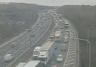
A Winter Storm Warning remains in effect through early Monday morning for the Louisville region, with major impacts expected to extend beyond the final flakes. The storm is set up with a sharp precipitation “battle zone” nearby: small shifts in temperature aloft can decide whether a given corridor gets more snow, more sleet, or a period of freezing rain. That matters because sleet can cut into snow totals but still create near-impossible driving, while freezing rain raises the stakes for trees, lines, and prolonged outages.
The high-confidence part is the impacts. Snow and ice are expected to significantly disrupt roadways and daily life, and that disruption will be amplified by bitter air behind the storm. The cold is not a footnote: after the main storm winds down, temperatures are expected to stay below freezing through much of the week, with wind chills dropping below zero late Sunday night into Tuesday morning. If power is interrupted, the cold becomes the emergency, not just the storm.
What radar is showing and why the model spread matters in plain English
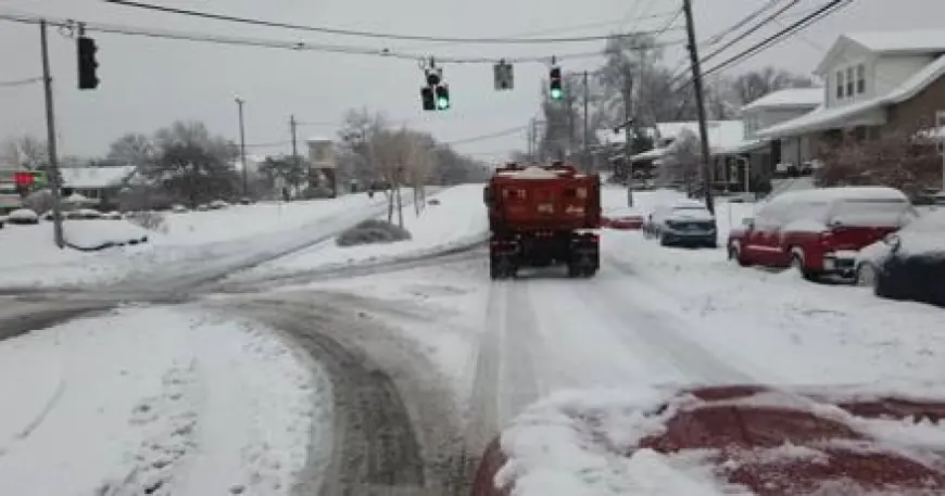
Radar trends Saturday night showed banding increasing from Louisville westward, with additional precipitation filling in to the south and moving north. Those bands can change conditions quickly: light snow becomes heavy snow, visibility drops, and roads that looked merely “covered” can turn impassable in a short window.
At the same time, forecast uncertainty isn’t about whether winter weather happens—it’s about the exact placement and timing of the warm layer aloft that decides precipitation type. Current guidance has shown a split between a warmer solution (favoring more sleet/freezing rain pushing farther north) and a colder solution (favoring more snow). In that spread, the GFS has leaned colder than the warmer, more aggressive alternatives. That difference is why totals and impacts can vary sharply over a relatively small distance.
For Louisville specifically, the expectation remains strongly tilted toward significant snow, with the heaviest rates most likely overnight and into Sunday. Nearby regions farther south face a higher risk of damaging ice, with some locations in the broader area projected to see ice accretion approaching three-quarters of an inch. Even if Louisville stays mostly snow-dominant, ice impacts south and southeast can still ripple into the metro through travel disruption, utility strain, and supply delays.
Timing snapshots (how the next 36 hours are likely to feel on the ground)
-
Saturday night (Jan. 24): Snow intensity increases; banding develops near and north of the Ohio River; visibility deteriorates.
-
Sunday (Jan. 25): Periods of snow continue; some areas near the transition zone may mix with sleet at times; road conditions remain poor.
-
Sunday night: Cold tightens its grip; wind chills fall sharply; any untreated surfaces refreeze fast.
-
Monday morning (Jan. 26): Warning window ends, but impacts don’t—cleanup is slowed by cold and lingering slick travel.
-
Midweek: A light-snow “clipper” remains possible, and it won’t take much moisture to create fresh accumulation given the cold, dry air mass.
Louisville’s current conditions already reflect how hostile the air mass is: temperatures are in the teens with snow ongoing, and overnight lows are expected to drop into the single digits and below as the cold deepens. Early week readings may dip below zero in the coldest hours outside the urban core, with daytime highs struggling to climb out of the teens.
The headline for anyone tracking “weather radar” right now is straightforward: this is not a one-and-done burst of snow. It’s a multi-step event—snow during the warning, a dangerous freeze behind it, and the possibility of additional light wintry rounds while snowpack keeps temperatures suppressed. The safest plan isn’t built around how much falls on your street; it’s built around how long you can function if travel is limited and heat becomes harder to guarantee.