


AccuWeather Highlights Major Snow-and-Ice Threat as Millions Track Minute-by-Minute Forecasts
AccuWeather is drawing heightened attention this week as a sprawling winter pattern lines up across large parts of the United States, pushing more people to check hyperlocal forecasts, snow and ice timing, and cold-risk guidance multiple times a day. Recent updates from AccuWeather’s meteorology team emphasize a wide-reaching storm setup capable of disruptive travel, scattered power outages, and dangerous cold in multiple regions, with impacts extending well beyond the usual snow belt.
The surge in interest is showing up in how people use weather apps during high-impact events: less focus on “Will it rain?” and more on “When does it start, when does it peak, and how bad will it be on my street?” That’s exactly the kind of question AccuWeather’s Minute-by-Minute tools and “feels like” temperature metrics are designed to answer, especially when precipitation type (snow vs. sleet vs. freezing rain) can change within a few miles.
AccuWeather’s Latest Call: A High-Impact Winter Setup
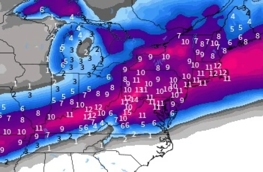
AccuWeather’s near-term messaging centers on a major storm sequence spreading snow and ice across a broad swath of the southern and eastern U.S., with a large population in the potential impact zone. The concern is not just heavy snowfall totals; it’s the combination of snow, icing, and a cold pattern that can make roads treacherous and slow recovery if utilities are affected.
The storm risk has a familiar “one-two punch” profile:
-
A surge of wintry precipitation that disrupts roads and air travel
-
Follow-on cold that can refreeze slush and worsen black ice overnight
-
Elevated power-outage potential where icing is significant
In practical terms, AccuWeather’s guidance is pushing users to plan around timing—when the first slick spots develop, when conditions deteriorate most sharply, and when temperatures drop enough to keep surfaces frozen for longer.
Texas Cold Focus: Grid Anxiety Returns With Long Freeze Windows
AccuWeather is also spotlighting a prolonged freeze risk in parts of Texas, with projections that some areas could remain below freezing for an extended stretch. That detail matters because long-duration freezes stress infrastructure differently than a quick overnight dip: pipes, roads, and even day-to-day logistics are challenged when temperatures do not rebound during daylight hours.
For households and small businesses, a multi-day freeze changes the checklist:
-
Water line protection becomes a priority, not a nice-to-have
-
Space heating demand can spike
-
Roads can stay hazardous even after precipitation ends
AccuWeather’s framing around “duration” is key here. People often prepare for the first night and underestimate what a second or third day below freezing does to systems that are built for milder winters.
Why AccuWeather’s App Is Getting Extra Attention Right Now
AccuWeather is actively promoting its app as a storm-prep tool, and the timing is not accidental. During high-impact events, users tend to rely on three things:
-
Real-time alerts (warnings for snow, ice, wind, and temperature extremes)
-
Radar and near-term precipitation tracking
-
Clear “impact” language that helps translate weather into decisions
AccuWeather’s ecosystem leans heavily into “actionable” presentation—what it feels like outdoors, how quickly conditions may change, and how long hazardous stretches might last. For many users, the value is less about a seven-day outlook and more about the next six to twelve hours: commute windows, school pickup timing, and whether a short errand turns into a slippery drive home.
Reading AccuWeather Forecasts in a Storm: What to Watch
When winter storms are in play, small shifts in temperature and storm track can change outcomes dramatically. If you’re using AccuWeather during an event like this, these are the fields that often matter most:
-
Precipitation type: Snow vs. sleet vs. freezing rain determines road treatment effectiveness.
-
Hourly temperatures: A 1–2°C shift can flip rain to ice in marginal zones.
-
Wind gusts: Blowing snow reduces visibility and can create drifting, especially in open areas.
-
“Feels like” temperature: Useful for frostbite risk and for understanding how quickly you’ll get chilled outdoors.
-
Timing of the changeover: When rain turns to freezing rain, conditions can deteriorate fast.
A common mistake in ice setups is over-focusing on total precipitation and under-focusing on temperature timing. Even modest amounts can become hazardous if they arrive right as roads cool.
What AccuWeather Users Should Do Next
AccuWeather’s current winter emphasis boils down to preparation and timing. Here’s the most practical approach for the next 24–48 hours if you’re in a threatened region:
-
Check the hourly forecast twice daily: morning planning and late-afternoon confirmation.
-
Set alerts for your exact location: warnings and advisories can be county- or neighborhood-specific.
-
Plan travel around the “first freeze” moment: the initial glaze is often the most dangerous.
-
Charge devices early: storms can mean outages or spotty service, and phones become critical tools.
-
Treat early signals seriously: if icing is possible, assume bridges and overpasses worsen first.
It’s also worth noting that storm forecasts can evolve quickly. If AccuWeather shifts the timing by a few hours, that can be the difference between a manageable commute and a gridlocked, slippery one.
The Bottom Line for AccuWeather This Week
AccuWeather’s latest focus is clear: a large winter setup with broad impacts, paired with heightened attention on cold duration in parts of the South. For users, the value is in staying nimble—watching the hourly trend, focusing on precipitation type and timing, and using alerts to avoid being surprised by a sudden change from “wet roads” to “ice everywhere.” In storms like these, the best forecast is the one you keep checking as conditions evolve.