


How many inches of snow today in NYC? Latest totals and what to expect on January 18, 2026
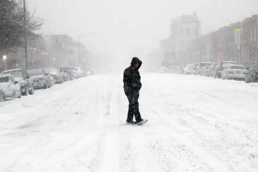
New York City is seeing a fresh round of snow today, with light to moderate bands sweeping across all five boroughs. As of late morning into early afternoon, accumulations have been spotty—generally coating colder surfaces first—while roads vary from wet to slushy where bursts intensify. Totals are still building, but the citywide picture points to a few inches by tonight, with the highest amounts likely away from the immediate coast and in eastern sections.
NYC snowfall today: what’s fallen so far
Snow began during the morning and has been intermittent, with intensity varying by neighborhood. Temperatures hovering near freezing have limited how quickly it sticks on heavily traveled streets, but park paths, untreated sidewalks, and car tops have accumulated faster. Early checks around the city showed roughly a dusting to around an inch in many spots by midday, with new bursts adding on through the afternoon.
Key takeaways so far:
-
Accumulation is uneven: shaded and elevated areas are collecting more than busy roadways.
-
Rates fluctuate: brief heavier bursts quickly add a half-inch to an inch, especially outside Manhattan.
-
Pavement vs. grass: grassy and untreated surfaces are outpacing roads in total accumulation.
How many inches of snow will NYC get today?
Forecast guidance and official advisories point to a general 1–3 inches across much of the city, with 2–5 inches possible in parts of eastern Queens and southeastern Brooklyn where bands linger longer. If a stronger late-day burst clips Manhattan and the Bronx, localized totals can nudge higher, but the most consistent signal keeps the bigger numbers to the east and into Long Island.
Why the range?
-
Marginal temperatures: Around 31–34°F means some flakes melt on contact, trimming totals.
-
Coastal influence: Marine air near the harbors and along the south shore slows accumulation.
-
Banding: Narrow, more intense snow bands can drop quick, localized inches in a short time.
Borough-by-borough expectations (today)
-
Manhattan: 1–3″, lowest near the southern tip and along the West Side, higher north of midtown and in Central Park vicinity if a late band passes.
-
Bronx: 1–3″, with isolated 3–4″ in the northeast if snow persists this evening.
-
Brooklyn: 2–4″ typical; 3–5″ possible in the southeast (Marine Park to Sheepshead Bay) if banding holds.
-
Queens: 2–4″ typical; 3–5″ possible in eastern sections and near the north shore where snow lingers.
-
Staten Island: 1–3″, edges of 2–4″ on the hills and away from the immediate waterfront.
Note: Ranges reflect totals through late evening. Localized higher pockets are possible where a heavier band parks for 1–2 hours.
Timing, travel, and what this means for the evening
-
Through afternoon (noon–4 p.m. ET): Periods of light to moderate snow, variable visibility, quick coatings in bursts.
-
Late afternoon to early night (4–9 p.m. ET): Another window for steadier snow; this is when most locations should reach their daily totals.
-
After 9 p.m. ET: Snow tapers from west to east, with lingering flakes and slick spots as temperatures dip.
Travel: Expect slush and slick patches on secondary roads, bridges, and ramps—especially during heavier bursts and after sunset. Major routes will fluctuate between wet and slushy depending on plow/salt cycles and snowfall rates. Give yourself extra stopping distance and watch for reduced visibility.
Factors that could change totals
-
Band placement: A 20–30 mile wobble in the snow band can shift the 3–5″ zone deeper into or out of the city.
-
Surface temperatures: If readings slip a degree or two below freezing this evening, road accumulations can increase, boosting final totals.
-
Mixing near the coast: Any brief mixing or drizzle along the immediate shoreline would trim amounts there.
Quick answers
-
How many inches of snow in NYC today?
Citywide, expect 1–3″, with 2–5″ possible in parts of Queens and Brooklyn by late evening. -
When will it end?
Snow diminishes west to east tonight, most areas winding down late evening into the early overnight. -
Will roads get worse after dark?
Likely yes in spots—cooling surfaces allow slush to stick and refreeze. Use caution on untreated streets, overpasses, and sidewalks.
Stay tuned for neighborhood-level updates as the bands evolve this afternoon and evening. Totals will vary street to street, but most of the city should finish in the low-single-digit range, with the best chance for higher tallies in the eastern boroughs.


