


Warm Weather Returns by Wednesday as Showers Persist
Lingering clouds and scattered showers continued over San Antonio following heavy rainfall that triggered flash flood warnings Monday. Officials say the most dangerous flooding has passed, but isolated high water remains in low-lying locations.
Rainfall totals and affected areas
Multiple flash flood warnings impacted Bexar, Comal, and Guadalupe counties during Monday’s storms. Several locations recorded between 5 and 7 inches of rain.
Notable heavy totals occurred near Stone Oak, Garden Ridge, New Braunfels, and Seguin. Other neighborhoods reported one to three inches of rainfall.
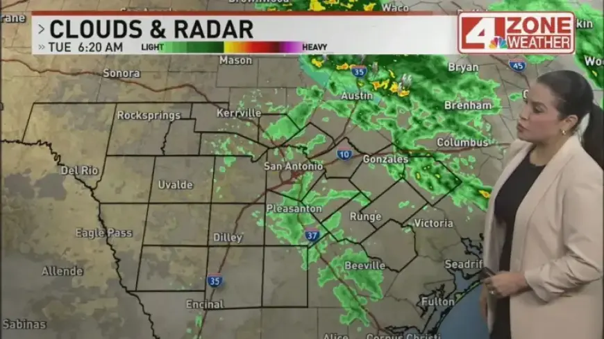
Today’s conditions and safety notes
Expect a cool, cloudy day with off-and-on showers and highs in the mid to upper 60s. Meteorologists put the chance of rain near 60 percent.
Additional rain should be lighter, generally a tenth to three quarters of an inch. A rumble of thunder is possible, but widespread flooding is not expected.
Travel and school precautions
Wet roads may slow commutes, so allow extra travel time. Southwest ISD posted that drivers will take added precautions for student safety after overnight rain.
Officials previously canceled some Fiesta events, including the River Parade, because of flood concerns.
Afternoon, evening and event guidance
Showers will become more patchy through the afternoon and evening. Drizzle or mist may linger at times.
If you plan to attend outdoor activities like NIOSA, bring an umbrella. Temperatures will hover in the upper 60s with only a small chance of light rain.
Midweek and weekend outlook
Warm conditions are expected to return on Wednesday, while scattered showers may persist in some spots. Wednesday’s highs should reach the upper 70s to low 80s.
Thursday into the weekend will bring a more pronounced warm-up. Skies will turn partly sunny as humidity rises, with highs climbing into the mid to upper 80s.
By the weekend, some areas could near 90 degrees as rain chances drop. The pattern should shift back toward a typical warm, humid spring regime.
For radar updates and to share weather photos, visit Filmogaz.com. Stay weather-aware and follow local advisories.