


Houston Weather Alert: Heavy Rain Triggers Storm Warning Until Sunday
Southeast Texas will see ongoing showers and thunderstorms Saturday evening. The most intense rainfall is expected late Saturday night into early Sunday morning.
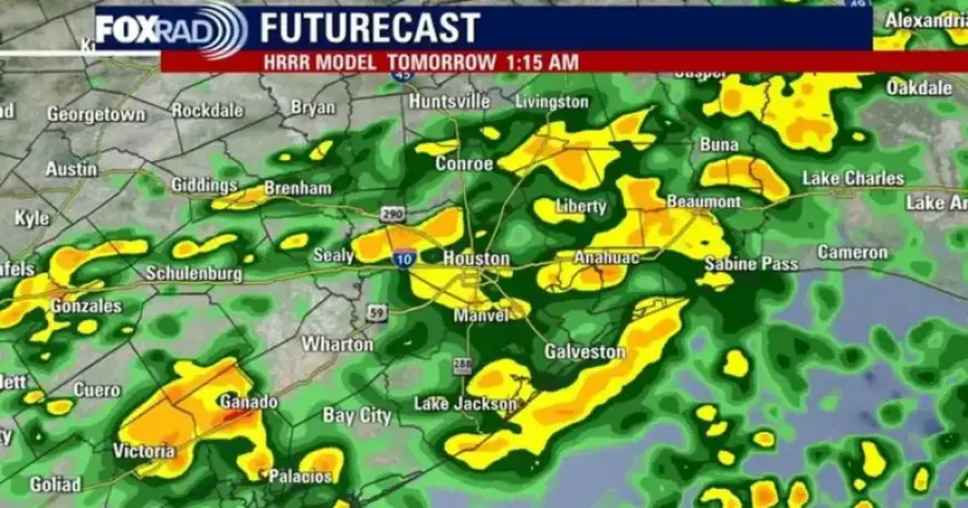
Timing and expected impacts
A cold front will move through the region this weekend. Rain chances rise Saturday, with the highest probability overnight into early Sunday.
Periods of heavy rain could produce 2–3 inches, or locally more. That rainfall may cause minor flash flooding on low-lying streets.
Storm threat
Some storms could become strong with brief heavy downpours. City and county roadways may see ponding after midnight Saturday.
Forecast models indicate the heaviest rain will occur overnight and taper off by 7 a.m. Sunday.
Post-front conditions
Behind the front, temperatures will fall into the 70s. Skies are expected to remain mostly cloudy with lower humidity.
The unsettled pattern will persist into early next week. Conditions should stay cooler than normal through Tuesday.
Outlook beyond Tuesday
Some warming is expected later in the week. However, clouds and spotty showers could linger at times.
- Area: Southeast Texas and Houston metro
- Date referenced: April 18 evening forecast
- Rain totals: periods exceeding 2–3 inches possible
- Heaviest rain: overnight Saturday into early Sunday, ending by 7 a.m.
- Temperatures: drop into the 70s after the front
This Houston weather alert emphasizes heavy rain and a storm warning into Sunday. Residents should monitor local advisories and avoid flooded roadways.
Source: Filmogaz.com.