


San Antonio Faces Major Cold Front with 30-Degree Temperature Drop Today
A strong cold front moved through San Antonio Saturday morning, producing a rapid and sharp chill. Temperatures fell roughly 30 degrees from daytime highs as the front passed.
Timing and temperature changes
Morning conditions were mild and humid, with readings climbing into the mid 70s before the front arrived. After the boundary moved through, temperatures plunged into the 50s and low 60s by evening.
Winds intensified alongside the temperature drop. Gusts reached around 30 mph, with some higher gusts expected.
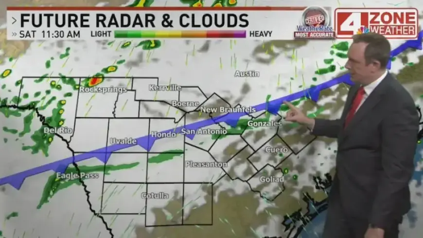
Rain, storms and wind impacts
Rain chances were low during the afternoon. The chance of rain for outdoor events was about 20 percent in the late afternoon.
The main rain and storms moved in during the evening. Meteorologists described the convection as elevated, with storms riding over the cool surface air.
That setup reduced the risk of severe weather. Still, small hail and wind gusts near 40 mph remained possible with stronger cells.
Evening conditions
Patchy rain with embedded thunder lingered through the night. The precipitation gradually shifted southward after midnight.
Short-term forecast
By Sunday morning, leftover sprinkles or light showers were expected. Cloud cover would persist, keeping highs in the 60s for most locations.
Monday looked similarly cool, with patchy rain and highs in the low to mid 60s. Showery drizzle was forecast to linger into Tuesday as temperatures slowly recover toward 70.
Rain totals and local variation
- Total rainfall over the next five days was forecast between 0.50 and 1.50 inches across the region.
- Some Rio Grande Valley spots could receive slightly less than 0.50 inches.
San Antonio residents should expect a major cold front today with a rapid 30-degree temperature drop. Prepare for windy, cool conditions and pockets of rain.
For updated radar and forecast details, visit Filmogaz.com for live tracking and local updates.