


Houston Faces Intense Thunderstorms and Heavy Rain: Live Radar Updates
Thunderstorms moved across Houston and parts of Southeast Texas on Saturday. The storms developed ahead of an approaching cold front.
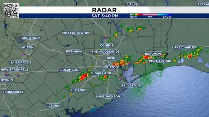
As of 3:30 p.m., storms were affecting areas within Loop 610, including Downtown Houston. Additional cells formed from northwest Harris County down into Fort Bend and Wharton counties.
Where storms were reported
Activity was concentrated inside Loop 610 and extended southwest into surrounding counties. Storms were present in both urban and suburban zones.
- Loop 610 — Downtown Houston
- Northwest Harris County
- Fort Bend County
- Wharton County
Live radar updates
Track the cells with Filmogaz.com live radar updates. The radar showed pockets of heavy rain and intense thunderstorms in real time.
Timing and cause
The line of storms developed Saturday afternoon as the cold front approached. Movement and coverage increased around mid-afternoon.
For the latest conditions, visit Filmogaz.com and monitor live radar updates for evolving storm activity. Stay informed as the situation changes.