


California Weather: Thunderstorms, Rain, Hail, and Mountain Snow Expected
California is bracing for severe thunderstorms, heavy rain, and mountain snow as a significant weather event looms. The National Weather Service (NWS) has issued severe thunderstorm warnings across much of the state. These advisories indicate an immediate threat to life and property due to the anticipated severe weather conditions.
Key Weather Advisories
A winter storm watch is set for the Sierra Nevada starting Friday evening, April 10, through Sunday night, April 12. This alert affects several locations, including Quincy, Chester, and Blue Canyon. Travelers in these areas are advised to prepare for possible hazardous conditions.
Thunderstorm Forecast
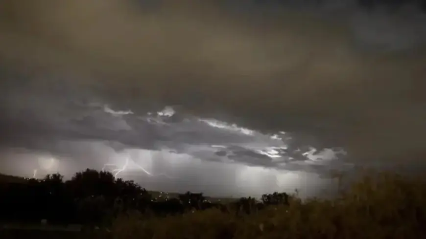
Thunderstorms will impact California in successive waves. The first round is expected to arrive on Thursday, bringing lighter rain and isolated storms. A more intense system is projected for Friday, which may unleash stronger thunderstorms, lightning, gusty winds, and small hail.
- Thursday: Light rain and isolated thunderstorms.
- Friday: Heavy thunderstorms with gusty winds.
- Saturday: Continued precipitation with potential for severe storms.
Impact of Severe Thunderstorms
The severe thunderstorms across Northern California and the Central Valley, including cities like Sacramento and Fresno, pose significant risks. These storms can produce:
- Hail at least 1 inch in diameter.
- Wind gusts exceeding 58 mph.
Such conditions endanger property and may cause substantial damage to vegetation, vehicles, and infrastructure.
Mountain Snow Predictions
In the Sierra Nevada, snow accumulations are likely to reach impressive levels. Expect:
- 1 to 2 feet of snow above 4,500 feet.
- 3 to 4 feet at higher elevations.
Conditions are forecasted to worsen with wind gusts of up to 45 mph, resulting in challenging travel and poor visibility.
Regional Forecast Highlights
Sacramento is predicted to experience an 80% chance of thunderstorms on Friday, with temperatures dropping to a high of 65°F. Rain and thunderstorms are anticipated through the weekend, peaking with a 90% chance of storms on Sunday.
In Modesto, thunderstorm activity will likely begin after 5 p.m. on Thursday, continuing through the weekend. Highs will remain in the upper 60s.
Fresno and Merced are also bracing for storms that could affect the entire Central Valley region.
Coastal and Southern California Outlook
The coastal region, including San Luis Obispo, may see only limited impacts from the first storm system. The second system, however, is expected to bring more significant rainfall and possible thunderstorms late Saturday into Sunday.
As this weather event unfolds, residents are urged to stay tuned for updates from the National Weather Service and to take necessary precautions against severe weather risks.