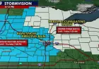


Tuesday Weather Alert: Monitoring Strong Storms and Heavy Rain Locally
A yellow-level alert is in effect for the Rochester, N.Y., area ahead of a multi-day weather change. Forecasters warn of rounds of heavy rain and the risk of storms Tuesday.
Tuesday threat details
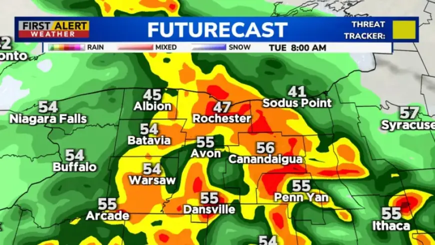
The Tuesday Weather Alert highlights the potential for heavy rain locally. Forecast totals are generally between 1 and 2 inches. Higher amounts are possible, mainly south of Rochester.
Thunderstorms may develop and some could become strong to severe. The main threats include gusty winds, frequent lightning, and hail. Expect downpours overnight into Tuesday morning and again later Tuesday afternoon into the night.
Temperatures and timing
Temperatures will vary across the region. Readings should be in the 50s near Lake Ontario. South of the Thruway, highs may reach upper 60s to low 70s.
Monday and immediate lead-up
Monday will offer a mild start to the week with mostly cloudy skies. Highs are expected in the 60s this afternoon. Gusty winds will pick up later, with a few showers possible in the late afternoon and evening.
Midweek through the weekend
Weather turns noticeably cooler Wednesday and Thursday. More showers are likely during that period.
Unsettled conditions continue into Friday and the weekend. Temperatures should moderate, returning near or above 60 degrees on Friday and Saturday.
Easter Sunday and beyond
An approaching cold front will affect Easter Sunday. Showers are likely to increase ahead of the front. Depending on its timing, Sunday may bring one last warm day or a day that trends cooler.
Cooler air is expected to settle in at the start of next week.
Impacts and advice
- Possible localized flooding where rain concentrates.
- Gusty winds that could bring down branches or power lines.
- Lightning and hail in stronger storm cells.
Residents should monitor forecasts closely and prepare for localized flooding. For ongoing coverage and updates, follow Filmogaz.com. Stay alert to short-term changes in timing and intensity.