


Chicago Weather Alert: Strong Storms, Large Hail, High Winds Expected | Live Radar
AccuWeather meteorologists issued an alert for Monday night and Tuesday across the Chicago area. The advisory warns of multiple rounds of strong storms and potential severe weather.
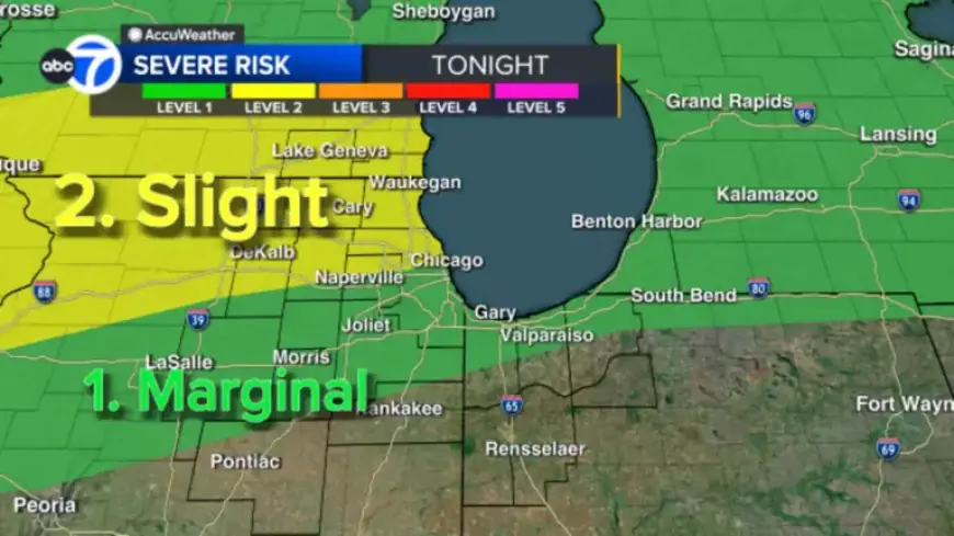
Warnings and watches
Several counties were placed under active warnings and a broader watch. Times and areas were specified by forecasters.
- Severe Thunderstorm Warning for Cook County and Lake County, Indiana, until midnight Tuesday.
- Severe Thunderstorm Warning for Kane County until 11:45 p.m. Monday.
- Severe Thunderstorm Watch for Boone, Cook, DeKalb, Grundy, Kane, Kendall, LaSalle, Lake County (Illinois), McHenry, Will, Racine, Walworth and Kenosha counties until 3 a.m. Tuesday.
Primary threats
Meteorologists Phil Schwarz and Cheryl Scott highlighted the main hazards. Large hail and damaging winds were emphasized.
They also noted a low tornado threat and the possibility of flooding in some locations. Residents were urged to check Chicago Weather Alert: Strong Storms, Large Hail, High Winds Expected | Live Radar.
Timing and movement
Scattered strong storms began to move into the region after 10 p.m. Monday. Areas north of Chicago had the highest severe risk.
Additional activity was possible overnight and into early Tuesday, followed by a temporary lull during much of Tuesday. A second round of strong storms is forecast after 4 p.m. Tuesday.
On Tuesday night the main threat will shift south of the city, with storms possibly continuing through midnight.
Temperature and short-term outlook
Temperatures climbed to 80 degrees Monday afternoon. That broke the old daily record of 79 degrees set in 1998.
It was also the warmest day of the year so far. Temperatures are expected to fall sharply late Tuesday as a cold front moves through.
Wednesday should be about 30 degrees cooler than Tuesday. More rounds of rain and storms are possible on Thursday and again on Saturday.
What residents should do
- Monitor local alerts and Live Radar feeds for real-time information.
- Seek shelter during thunderstorms and avoid flooded roads.
- Prepare for sudden wind damage and hail in the warned counties.
| When | What |
|---|---|
| After 10 p.m. Monday | Rounds of scattered strong storms moved into the area. |
| Overnight–early Tuesday | Additional storms possible, highest risk north of the city. |
| Tuesday afternoon | Dry and warm conditions expected before storms return after 4 p.m. |
| Tuesday night | Main threat shifts south, storms may continue through midnight. |
| Wednesday | Significant cooling, roughly 30 degrees below Tuesday highs. |
| Thursday & Saturday | Additional rain and storm chances across the region. |
Filmogaz.com is streaming continuous weather updates and radar. Viewers should follow local guidance and avoid travel during severe cells.