


High Wind Watch: Gusty Santa Ana Winds to Batter Southern California, Yosemite Under Advisory
A new high wind watch is in effect as gusty northerly flow is expected to push through Southern California and a separate wind advisory covers high elevations around Yosemite and nearby Sierra parks. These wind threats matter because strong gusts are primed to topple tree limbs, damage unsecured objects, disrupt travel across major corridors and, in some areas, cause brief power outages.
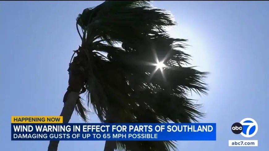
High Wind Watch: SoCal wind warnings and Santa Ana outlook
Gusty winds are moving across the region, with a moderate to strong northerly event forecast to peak during a Thursday morning period and then taper while remaining breezy. Specific warning areas include the San Gabriel Mountains and the 14 Freeway corridor under a wind warning valid through a Thursday morning time with gusts up to 65 mph possible, and the Santa Monica Mountains Recreational Area and Malibu Coast under a warning for a morning window with potential gusts to 60 mph.
An expanded pattern will transition into a moderate to strong Santa Ana wind event beginning Friday morning and lasting into Sunday, with Saturday likely the windiest day. Most likely winds for the Santa Ana event are in the 20-30 mph range with gusts of 40-50 mph; damaging gusts of 55-70 mph remain possible, with higher probability across mountain zones and a reduced chance along coasts and valleys. These Santa Ana winds are expected to warm temperatures over the weekend, peaking later with highs rising into the 70s and mid-80s in much of the area.
Where winds will be strongest and expected impacts
Advisories and warnings identify the locations and expected gust ranges:
- San Gabriel Mountains and the 14 Freeway corridor: wind warning through a Thursday morning period; gusts up to 65 mph possible.
- Santa Monica Mountains and Malibu Coast: wind warning for an early morning window; gusts potentially up to 60 mph.
- Antelope Valley and Antelope Valley foothills: wind advisory through a Thursday morning period; gusts up to 55 mph possible.
- Santa Clarita and San Fernando valleys, Calabasas and Agoura Hills: advisory through a Thursday morning period; winds could reach 50 mph.
- Los Angeles County beaches, Palos Verdes Hills and Catalina Island: advisory through a Thursday morning period; winds expected near 40 mph.
These winds will funnel through canyons and passes, bringing northerly flow into atypical parts of western Los Angeles County and creating hazardous travel conditions on major freeways. Crosswinds are anticipated to disrupt freeway travel and cause travel delays at the region’s primary airport. Saturated soils from recent storms raise the risk of downed trees and wires rather than elevated fire danger in the near term.
Yosemite and Sierra high-elevation advisory, safety steps
A separate wind advisory covers Yosemite, the Upper San Joaquin River area, Kings Canyon National Park, Sequoia National Park and the southern end of the Upper Sierra. The advisory window runs from an evening start through a Saturday evening end, with northeast winds of 20-30 mph and gusts up to 50 mph expected, primarily impacting areas above 8, 000 feet.
Expected impacts at high elevations include blown unsecured objects, knocked-down tree limbs and the possibility of a few power outages. Strong gusts can make driving difficult for high-profile vehicles; extra caution is advised when traveling in affected areas.
High wind alerts fall into tiers that guide response: the most severe tier calls for seeking shelter because sustained strong winds with even stronger gusts are occurring; a mid tier advises securing outdoor items and taking care while driving; a lower tier recommends preparing by securing loose objects and adjusting plans to avoid being caught outdoors during peak winds.
Residents and travelers in affected areas should secure loose outdoor items, expect possible tree and power impacts, and allow extra time for travel. The situation spans multiple days, and details may evolve as the northerly event finishes and Santa Ana conditions develop into the weekend.