


Ksl warns: Winter weather advisories cover Utah mountains as valley snow becomes possible
ksl — A storm that moved through northern Utah earlier this week brought heavy precipitation to some communities and has prompted the National Weather Service to issue winter weather advisories for the state's mountains as a new system pushes in later this week.
Storm soaked parts of northern Utah and boosted mountain snowpack
The recent system dumped nearly a half-inch of rain in Provo, 0. 83 inches in Salt Lake City and more than 2 inches across several communities north of the capital, including over 2 inches in North Ogden. Resorts at Beaver Mountain and Cherry Peak each collected a foot of snow, helping a mountain snowpack that remains weak — the statewide snow water equivalent is 8 inches, just above the record low for early March.
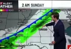
Ksl meteorologist highlights timing and expected totals
KSL meteorologist Matt Johnson said, “It's not a huge storm here, but it is going to provide some pretty good snow, ” and noted that the brunt of the next system will pass just east of Utah. Wednesday will be mild and breezy with upper 50s and lower 60s along the Wasatch Front, before a low-pressure system over the Pacific Northwest moves into Utah by Wednesday afternoon or evening.
The National Weather Service’s advisories cover mountains and high-elevation communities, which could receive another foot of snow or more by the end of the workweek. Forecast snowfall ranges listed in the advisories include 6 to 12 inches for the Wasatch, West Uinta and central mountains between Wednesday night and Friday afternoon, with up to 18 inches possible in the upper Cottonwood Canyons.
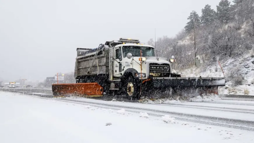
Valley rain may switch to snow; travel impacts possible through Friday
The incoming system is expected to bring a mix of valley rain and mountain snow to northern Utah first, then sweep across more regions early Thursday. Snow showers are more likely by Thursday afternoon and evening, and advisories keep those snow showers in play from north to south, all the way down to Fillmore. Rain may switch over to snow in the valleys as the initial cold front passes.
Wasatch Back communities could see 2 to 6 inches by Friday evening, while the Wasatch Plateau/Book Cliffs and southern mountains are forecast for 2 to 8 inches. The Sanpete and Sevier valleys could pick up 1 to 3 inches. More scattered showers are possible through Friday afternoon, creating a risk of slick morning commutes on Thursday and Friday.
The National Weather Service had initially issued a winter storm watch for parts of the state but downgraded those areas to match the advisories now in place. Forecasts note that estimates are highly uncertain and depend on where the snow line forms; forecasters expect at least a trace of snow from Logan to Cedar City between Thursday and Friday, with the odds of at least an inch varying by location.
Officials say the system should clear by the start of the weekend, with scattered showers tapering off after Friday afternoon and mountain snow helping the strained snowpack ahead of spring runoff.