


Snow Totals: Millions Grounded as Northeast Records Historic Accumulation, Schools Close and Flights Disrupt
An intense storm that struck the Northeast on Monday produced dramatic snow totals and immediate disruption: millions stayed home, transit was immobilized, officials declared emergencies, and major institutions postponed plans. Here’s the part that matters for residents and services—the depth and weight of the snow have driven shutdowns, power failures and emergency responses across a wide swath from Maryland to Maine.
Snow Totals and who felt the impact first
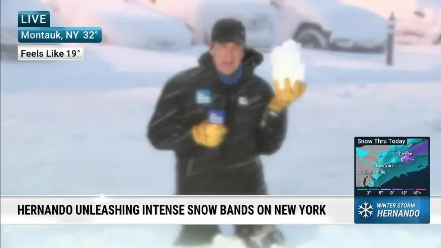
The storm dumped more than 2 feet (60 centimeters) of snow in parts of the metropolitan Northeast, shattering accumulation records in some places and prompting school and business closures. New York City recorded its first “old-school” snow day in six years; Central Park measured 19 inches (48 centimeters). Warwick, Rhode Island, exceeded 3 feet (91 centimeters), topping the nation so far. These totals translated into immediate decisions to keep millions at home and suspend routine travel.
How meteorologists characterized the system and what could follow
The National Weather Service called Monday’s event a classic bomb cyclone/nor’easter off the Northeast coast. A bomb cyclone is defined as a storm whose pressure falls by a certain amount within 24 hours, typically in fall and winter when frigid Arctic air can push south and clash with warmer air. Meteorologists described a “Goldilocks situation” of temperature and moisture that produced wet, heavy snow—warm enough to carry moisture but cool enough for snow—an assessment credited to Owen Shieh, warning coordination meteorologist at the National Weather Service’s Weather Prediction Center in Maryland. Even as snow moved northward and tapered off in some areas, the service is tracking another storm that could bring more snow later this week.
Scenes on the ground and personal accounts
Lower Manhattan showed how rapidly daily life shifted: snow shovelers appeared to outnumber commuting office workers and pedestrians moved freely in streets normally clogged at rush hour. Luis Valez, a concierge at a residential tower just off Wall Street, cleared sidewalks and said it was very quiet except for howling winds; only a couple of residents went out for essentials. In Brooklyn, 57-year-old attorney Matthew Wojtkowiak was shoveling and described the conditions as “not too bad, not too easy, ” noting that schools were closed and expressing hope people might still get out and enjoy the snow. Visitors from the United Kingdom, Karen Smith and Adele Bawden, said they danced in Times Square in the middle of the road. Ingrid Devita said she patroled the Lower East Side on skis to check on residents and that she often finds people who fall in the snow and cannot get up.
Infrastructure strain, wind records and cultural sites affected
Power failures were widespread as officials and utilities grappled with heavy, wet snow. The highest wind gust recorded was 83 mph (133 kph) in Nantucket, with hurricane-force gusts reported across Cape Cod. Transportation shutdowns disrupted flights and transit, and the United Nations postponed a Security Council meeting. Emergency declarations were issued in multiple jurisdictions as crews responded to the storm’s impacts.
In Connecticut, crews at the Mystic Seaport Museum prepared to clear snow from a fleet of historic ships, including the 113-foot-long Charles W. Morgan, a wooden whaling ship from the 19th century American merchant fleet. Shannon McKenzie, vice president of watercraft operations and preservation, said shipyard staff will clear the snow by hand using rubber or plast
- Central Park: 19 inches (48 cm)
- Warwick, Rhode Island: more than 3 feet (91 cm)
- Metro Northeast pockets: over 2 feet (60 cm)
- Highest gust: 83 mph (133 kph) in Nantucket; widespread hurricane-force gusts on Cape Cod
What’s easy to miss is how the combination of depth and wind converted heavy snow into broader hazards: fallen trees and power outages, longer clearance times, and strains on emergency services. The real test will be how quickly crews can restore power and reopen transit as the storm moves northward and a second system is tracked for later in the week.
There are also visual records emerging under the title NY 'A World Transformed' that show city streets and public spaces reshaped by the storm’s snow and wind.
If you’re wondering why this keeps coming up, the winter timing—when Arctic air can collide with warmer coastal moisture—made this storm both powerful and record-setting in parts of the region.
Key takeaways:
- Millions were forced to stay home; schools and many businesses closed across the storm’s path from Maryland to Maine.
- Transit immobilization and flight disruptions accompanied emergency declarations and reported power failures.
- Record and near-record snow totals were logged in multiple locations, with Warwick, Rhode Island, topping the nation so far.
- A second storm is being tracked that could deliver additional snowfall later in the week; schedules and recovery remain subject to change.
Timeline rewind: the storm struck on Monday and produced the region’s heaviest snowfall in a decade for some areas. New York City experienced its first traditional snow day in six years. Recent updates indicate tracking continues on an approaching system; details may evolve.
Artist’s aside: The bigger signal here is how a single meteorological setup—right temperature and abundant coastal moisture—can overwhelm infrastructure and public life across multiple states in hours.