


Snow Storm Weather Forecast: Warnings for Snow, Heavy Rain, Ice and Travel Disruption Across the UK
The Snow Storm Weather Forecast for the UK shows multiple yellow warnings in force for rain, snow and ice, with authorities warning of travel disruption, flooding risk and possible power cuts; the pattern matters because it affects counties across Wales, parts of England, Northern Ireland and high ground in Scotland.
Snow Storm Weather Forecast: where warnings are in force
Yellow Met Office warnings cover rain and snow across Northern Ireland, yellow rain warnings cover southern parts of England, and a further yellow warning for snow is due to begin later for parts of Wales, the Midlands and the southern Pennines. An ice warning for Wales is scheduled to kick in during the evening. Yellow National Severe Weather Warnings remain in force until Thursday morning.
Rain, wind and wintry hazards: expected precipitation and winds
Heavy rain is expected in southern England through Wednesday and into Thursday, with many areas likely to see 10-20 mm, 20-30 mm possible along the south coast and up to 50 mm across Dartmoor. In the wettest locations, 30-50 mm of rain could fall, creating a real threat of worsening flooding in areas already affected during the first part of 2026. Strong east to northeasterly winds will accompany the rain, and large waves may affect east-facing coasts, particularly along the English Channel. Wind gusts of 45-55 mph are identified as an extra hazard in some areas.
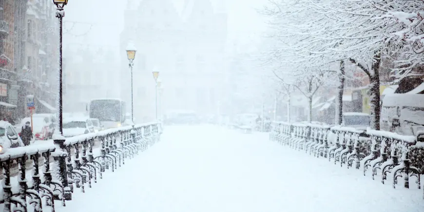
Snow, sleet and hill accumulations: who will be worst hit
Frontal systems will move rain and snow into Northern Ireland and southern and central Britain. Northern Ireland will see persistent rain at low levels with snow over high ground, especially the Sperrins; several centimetres could accumulate above 250 metres in those uplands. As the rain shifts northwards into Wales, the west Midlands and northern England during the late afternoon and evening, some precipitation will turn to snow over hills. Several centimetres are expected to accumulate over high ground above around 150-200 m elevation, with the possibility of up to 15 cm over the highest ground of mid and south-east Wales, Herefordshire, Shropshire and the southern Pennines.
Wales focus: county-level warnings and local impacts
Forecasters have highlighted a yellow warning affecting 18 counties in Wales with snow expected until 06: 00 GMT on Thursday and an ice warning in the same area in effect until 10: 00 on Thursday. People living on higher ground in mid and south-east Wales could see up to 20 cm (8 in) of snow. The counties listed under the yellow warnings are Blaenau Gwent, Bridgend, Caerphilly, Carmarthenshire, Ceredigion, Conwy, Denbighshire, Gwynedd, Merthyr Tydfil, Monmouthshire, Neath Port Talbot, Newport, Pembrokeshire, Powys, Rhondda Cynon Taf, Swansea, Torfaen and Wrexham. Travellers can expect a small chance of delays on roads due to stranded vehicles and impacts on train and flight schedules. There is a slight chance that some rural communities could become cut off, and a small chance of power and mobile service cuts, with strong winds forecast.
Cold snap context and highland effects
North-westerly winds have led to a drop in temperatures across the country in recent days. Temperatures on Tuesday night fell below -9C (16F) in parts of north-east Scotland, and many northern and central areas experienced a frosty start to Wednesday. At lower levels a mix of rain and sleet is more likely, with the possibility of a little wet snow at times. Some snow could also start to affect the Peak District, the Pennines and possibly south-west Scotland during the night.
Official guidance, outlook and other disruptions
The UK Health Security Agency has issued a cold weather alert covering most of England until 18: 00 GMT on Friday. Chief Forecaster Jason Kelly set out expected snowfall ranges: 2-5 cm likely above 150-200 m, and 10-15 cm possible above 250-300 m across mid and south-east Wales, Herefordshire, Shropshire and the southern Pennines, with small amounts generally less than 2 cm at lower levels. Any lying snow in parts of Northern Ireland should thaw during the evening and overnight. As the system clears on Thursday, most areas will turn drier, though Northern Ireland and western Scotland will see cloud and rain increasing by the afternoon and further ice warnings overnight remain possible.
Other disruptions noted alongside the UK warnings include travel restrictions elsewhere linked to a nor'easter storm, including a full travel ban in New York City. Footage has shown an individual named Sam Dudley appearing shocked at the sight of a train. Trains now stop at Northumberland Park after running through the station for more than a year. An airline has warned of major disruption after fog left its aircraft in the wrong place, and an airport has described a measure as a faster, more convenient option in line with other airport charges. The forecast situation contains uncertainty and details may evolve; keep up to date with hour-by-hour forecasts on official weather websites and mobile apps.