


Weather Boston: Potential Blizzard Could Drop a Foot or More Monday as Nor'easter Strengthens
A major nor'easter threatens the region this weekend, and weather boston maps show a potential blizzard that could drop a foot of snow or more on Monday. The system is expected to intensify rapidly as it moves north-northeasterly, raising concerns about heavy, wet snow, extreme winds, coastal flooding and dangerous travel conditions.
Weather Boston: Storm timing and evolution
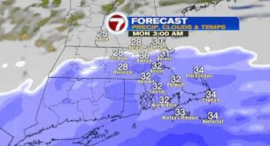
The storm will begin taking shape Sunday as it emerges off the southeastern U. S. coast and is expected to move north-northeasterly late Sunday night into Monday. Rapid intensification of the low is expected as it tracks near the benchmark 40N/70W, a classic setup for a strong New England nor'easter. The first flakes could arrive just after sunset on Sunday, with the steadiest snow spreading from south to north between about 10 p. m. Sunday and 3 a. m. Monday (ET).
By dawn Monday the storm is forecast to be raging, with heavy snow and very strong winds. The storm peak is expected to begin just before dawn Monday and last through Monday afternoon, then taper slowly overnight into early Tuesday. Snowfall rates in the heaviest bands could exceed 1 inch per hour for several consecutive hours during the peak, making travel absolutely treacherous.
Storm totals, banding and regional impacts
Forecast snowfall totals are concentrated along and east of I-95:
- 10–16 inches across eastern Massachusetts, including the North and South Shores, Boston metro, Cape Cod and the Islands.
- 6–10 inches expected west of the Worcester Hills, tapering farther west.
- Localized extreme banding may produce higher totals in favored coastal zones, with a zone of lower totals possible immediately to the west of any jackpot band.
Coastal and island areas are likely to see the heaviest, wettest snow. Heavier coastal snow increases the risk of power outages and roof collapse in areas that receive high accumulations of wet, dense snow.
Wind, coastal flooding and travel impacts
Wind is a major concern with this nor'easter. Northeast gusts are expected to reach 55–70 mph or higher across southeastern Massachusetts, Cape Cod and the Islands, with inland gusts generally lower but still impactful. The combination of heavy snow and strong onshore winds will likely produce blizzard or whiteout conditions in many areas.
Coastal flooding is also expected during several high tide cycles. A coastal flood watch is in effect for the Monday and early Tuesday high tides, with minor to moderate flooding possible and inundation on the order of 1 to 3 feet at vulnerable locations. Early high tide cycles that coincide with peak winds and surge are timing points of greatest concern for coastal inundation.
Travel impacts will be widespread. With intense snowfall rates, strong winds and whiteout conditions during the storm peak, both the Sunday night–Monday morning and Monday evening commutes are expected to be heavily impacted. Tuesday is expected to be a clean-up day in many places, with lingering travel problems on unplowed secondary roads.
Near-term forecast notes and preparation
Light snow and spotty accumulations are possible through Saturday, with colder readings Sunday morning and a relative lull during Sunday daytime hours before the late-night northeasterly surge. Residents should prepare for significant snow, widespread power outages where heavy wet snow combines with high winds, and coastal flooding at several high tide cycles. Details may evolve as the storm consolidates and specific banding and track features become clearer.
For immediate planning, expect the heaviest impacts to focus along the coast and down through Boston to the South Coast and Cape Cod, with the timing concentrated overnight Sunday into Monday and a gradual wind-down Monday night into early Tuesday.