Boston Weather: Storm Maps Show Where Rain, Sleet, and Snow Will Hit Friday — Nor’easter Threat Follows
The latest storm maps show an active stretch for New England, with a winter system arriving Friday afternoon that will bring cold and freezing rain, sleet, a wintry mix and eventually plain snow to parts of the region. This setup matters for boston weather because precipitation will intensify in the afternoon and evening, creating iffy road conditions before tapering off overnight.
Boston Weather: Friday's wintry mix, timing, and local totals
The Friday event is expected to begin with a warm front moving east ahead of the storm’s core and carries a notable risk that a secondary low will form over the ocean, boosting precipitation at times. For southern portions of New England, precipitation will start as a wintry mix and cold rain, especially along the coast and in areas south of the Mass Pike. The rain-snow line is forecast to shift southward Friday evening into the night, when snow accumulation becomes possible.
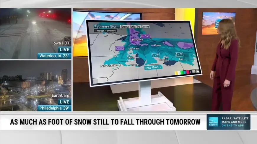
Forecast storm-impact maps place most of greater Boston and nearby communities in a 1–3 inch band of expected accumulation by noon Saturday, with higher totals north of the city. Northern parts of New England are expected to see snow from the start of this system, with bands of 3–6 inches and isolated 6–8 inch totals in parts of interior regions.
- 6–8 inches: Central sections of Vermont and New Hampshire, and parts of western coastal states in the far northeast.
- 3–6 inches: Areas north of main east–west corridors and north of the Boston metro, including northern Berkshires and several inland cities.
- 1–3 inches: Greater Boston, the South Shore to roughly Scituate, Worcester, Springfield, northern Rhode Island and Connecticut.
- Coating–1 inch: South Shore communities, and certain coastal and outer capes.
- Rain or wintry mix: The entire southern coast of New England, including most of the Cape and the islands.
Nor’easter Risk: Which spots could see blizzard-like conditions and major impacts
Looking beyond Friday, a separate nor’easter threat is likely to impact Massachusetts late Sunday into Monday, with meteorologists warning of heavy snow and blizzard-like conditions in spots. Southeastern parts of the state — especially the Cape, Islands, South Coast and South Shore — are expected to face the heaviest snow, with more than a foot possible in some areas.
For the Boston-area, forecasters consider 6 inches or more a real possibility from the Sunday night into Monday timeframe, with some guidance ranging 4–8 inches for the city and up to 12 inches on the Cape and Islands. Strong winds are expected with the system, generally in the 40–50 mph range, and confidence is growing for widespread gusts above 50 mph across exposed coastal areas.
Those winds raise the risk of downed trees and power lines, making outages possible. A Winter Storm Watch has been issued for the Cape, Islands and South Coast, and high winds and coastal watches have been placed for the same shoreline zones. Offshore conditions may become dangerous, with potential for very large seas that could threaten vessels and visibility; mariners are advised to consider altering plans.
Travel and next steps — what to expect and when to plan
Friday’s precipitation is likely to make afternoon and evening travel challenging in many spots, with conditions improving overnight as precipitation tapers. The separate nor’easter threat for Sunday night into Monday could further disrupt travel, with heavy snow and strong winds making commutes — particularly Monday morning — slow and potentially hazardous.
Because the situation includes multiple systems and a risk of track shifts, forecasts and watches could change. Stay tuned to the evolving storm maps and local briefings for updated timing and impact details; planners should prepare for slick roads Friday evening and heightened coastal impacts from the later nor’easter.
