


Winter Storm Warning Weather: California Braces for Up to 8 Feet of Snow
A powerful pair of Pacific storms that began Sunday night ET is expected to pound California through the week, prompting winter storm warnings and urgent safety messages. Forecasters say the strongest impacts will be in Northern California and the Sierra Nevada, where heavy snow, high winds and dangerous travel could make some roads impassable.
Where the biggest impacts are expected
Forecasters are calling for the most severe conditions on the western slopes of the Sierra Nevada, in parts of Shasta County and along the coastal ranges of Northern California. Higher elevations in those zones could see four to eight feet of snow over several days, with lower elevations receiving up to a foot. Snow began falling Sunday night ET above roughly 5, 000 feet in the Siskiyou Mountains, Mount Shasta area and the Salmon Mountains, and is forecast to expand into the Sierra Nevada by Monday ET.
Valleys and foothills will not be spared: in some higher Sierra valleys three to five feet is possible, with one to three feet in lower valleys around Lake Tahoe and Mono County. Snow levels may drop sharply, reaching as low as 1, 000 feet in parts of the Sierra and below 1, 000 feet in Shasta County, increasing the risk of travel disruptions at elevations that do not normally see significant snow.
Travel, wind and other hazards
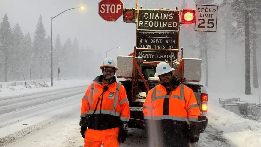
A winter storm warning remains in effect through 10 p. m. Thursday ET for large swaths of the Northstate, with forecasts calling for near-whiteout conditions, major travel delays and possible road closures. Wind gusts between 45 and 55 mph are expected in some areas, capable of producing drifting snow and bringing down tree limbs and power lines. Motorists are being urged to avoid travel if possible; officials warn that conditions can deteriorate rapidly, especially on Interstate 80, Highway 50 and sections of Interstate 5.
"The biggest concern is actually some of the roads up in that area — they're going to be impassable, " a meteorologist at the Weather Prediction Center said, stressing that chain controls and road closures are likely. Travelers who must be on the road should carry extra food, water and a flashlight in their vehicle, and allow extra time for delays. Road crews are expected to work around the clock as conditions allow, and motorists are advised to give snowplows plenty of space.
Flooding, mudflows and community preparations
Heavy rain is forecast to spread into parts of southern and central coastal Southern California by Monday morning ET, raising concerns about debris flows and mudslides in burn-scarred areas. Officials warned residents in neighborhoods below recent fire scars to be prepared to evacuate on short notice; evacuation warnings were scheduled to take effect Sunday night ET in the most vulnerable zones.
Local law enforcement and emergency operations centers have urged residents to secure outdoor items, prepare emergency kits and check on neighbors who may need assistance. One county sheriff's office advised that while much of the year has felt spring-like, "winter is set to show it’s not quite done yet, " and encouraged people to take the warnings seriously.
A second storm arriving Tuesday ET could bring additional rounds of heavy mountain snow and amplify impacts through midweek. Forecasters emphasize that snowfall totals will vary dramatically by elevation and location, and that ongoing updates will be critical for anyone planning travel or outdoor work this week.