


Severe Storm Threat Spreads Across the Southeast; Georgia Braces for Strong Storms and Isolated Tornadoes
A powerful cold front sweeping east across the Deep South is elevating the risk of damaging winds, small hail, frequent lightning and isolated tornadoes in portions of the Southeast, including parts of georgia. Meteorologists say the line of showers and storms will progress from west to east through the evening, and communities are being urged to prepare for possible outages and localized damage.
What to expect today and tonight
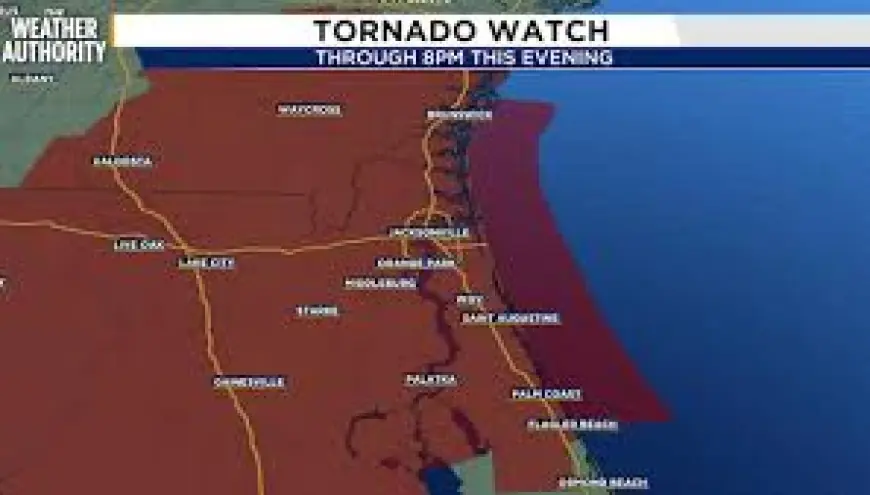
The advancing line of storms is expected to push through the region this evening, with the most intense activity moving through before nightfall. A tornado watch is in effect for parts of the area through 8: 00 p. m. ET. Temperatures near 80 degrees, combined with high moisture and gusty winds, are creating an environment that can support strong to severe thunderstorms. Forecasters have placed the region at a level 2 out of 5 on the severe-weather scale, indicating a heightened but not extreme threat.
Residents across Georgia—especially in coastal and southeastern counties—should anticipate a round of heavy rain, with localized totals from about 0. 5 to 1. 5 inches possible late Sunday into Monday morning. While much of the precipitation will be welcome in drought-affected areas, the quick influx of water paired with strong winds raises the chance for downed trees and power lines.
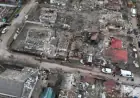
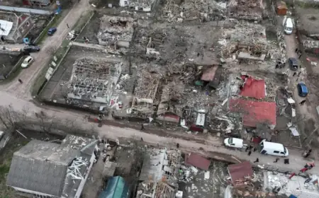
Damage and outages already reported across the Gulf Coast
Overnight storms produced widespread impacts in parts of Louisiana and Mississippi, with thousands of customers losing power and multiple instances of structural and vegetation damage. Officials in Ascension Parish noted downed utility poles and snapped lines along a key highway span. Reports of fallen trees and property damage have also come from Tangipahoa and East Feliciana parishes as well as communities in southern Mississippi, where a damage survey is scheduled to assess storm impacts on Monday, February 16, at 1: 45 a. m. ET. One community near Centreville experienced several downed trees and yard debris, and another saw a toppled power pole.
Those outages and damage incidents underscore the potential for similar localized impacts in georgia if the strongest portions of the storm track through populated areas. Even where storms remain sub-severe, fallen limbs and scattered outages are likely where winds gust strongly.
Preparedness steps for Georgia residents
Residents should take common-sense precautions now to reduce risk and speed recovery if the storms affect their area:
- Secure loose outdoor objects and bring vehicles, patio furniture and trash cans under cover if possible.
- Charge phones and portable batteries and ensure flashlights and first-aid supplies are accessible.
- Review a family communications plan and identify safe interior spaces away from windows for sheltering during high winds or tornadoes.
- Expect potential power outages; have a plan for medical devices that require electricity and avoid downed power lines.
- Monitor local emergency alerts and listen to public safety guidance for road closures or evacuation notices.
Although drier, sunnier weather is forecast to return later in the week as high pressure builds in, the immediate window presents the greatest threat for severe storms. Residents across georgia should remain vigilant through tonight and into Monday morning, and be prepared to act quickly if warnings are issued for their area.