


Pittsburgh Set for Extended Warm Spell After Sub-Zero Night
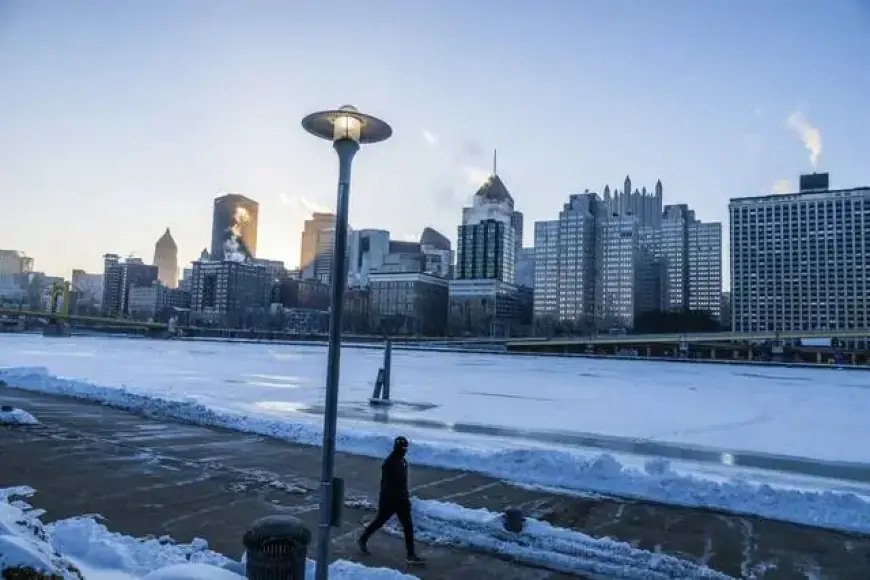
Pittsburgh is set to transition from weeks of frigid temperatures to a warm spell beginning Monday. After an overnight low of -2 degrees, the region will experience a significant temperature increase, with highs climbing to or above freezing.
Pittsburgh’s Weather Outlook
The National Weather Service forecasts a dramatic warming trend for Pittsburgh and surrounding areas. A cold weather advisory for Allegheny, Armstrong, Beaver, Butler, and Westmoreland counties remains in effect until 10 a.m. on Monday.
Monday’s Temperature Rise
- Expected high: Near 30 degrees Fahrenheit by mid-afternoon.
- Winds predicted to be lighter, eliminating wind chill factors.
Impact of Recent Cold Snap
The recent cold spell significantly disrupted daily activities. More than 200 school districts, including Pittsburgh Public Schools, began the day with a two-hour delay. Only a few districts opted for closures.
Looking Ahead to Tuesday
- Projected high temperatures: 40s for most of the metro area.
- Some areas south of Interstate 70 might approach 50 degrees.
While this warm spell won’t last long, the rest of the week is expected to see temperatures stabilizing in the low 30s. By week’s end, lows will drop to the teens but remain above zero.
Flooding Concerns
According to meteorologist Matt Burdy, there are currently no concerns regarding river flooding from melting ice. He noted that a substantial warm-up of 40 to 60 degrees over several days, paired with rain, would be necessary to trigger flooding.
Precipitation Forecast
A slight chance of precipitation is expected late Tuesday into early Wednesday, potentially bringing flurries mixed with rain.