


NYC Cold Weather: Extreme Cold Warning, Wind Advisory Impacts, and the Polar Vortex Outlook for the Week Ahead
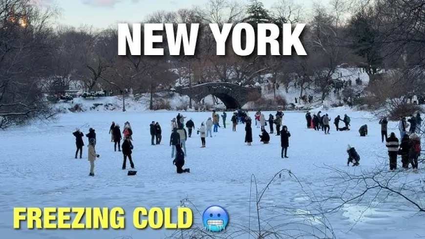
New York City is coming out of a dangerous cold snap as the region transitions from an Extreme Cold Warning into a period of continued bitter wind chills and lingering wind impacts. Forecasters say the worst of the cold is easing, but conditions remain hazardous for anyone outdoors for extended periods, especially overnight and early morning, when wind chills can drop well below zero.
The current setup is a classic polar vortex-driven Arctic air outbreak: a surge of very cold Canadian air pushed south, then reinforced by gusty northwest winds that make it feel even colder than the thermometer suggests.
What’s happening right now in NYC
As of this afternoon in Eastern Time, skies are generally clear and the air is frigid. Temperatures are in the teens, with the daytime high today near the mid-20s Fahrenheit and a low around the low teens tonight. Winds remain a key threat because they accelerate heat loss from exposed skin.
The most important detail for safety is wind chill, not air temperature. Even if you see “20s” on the forecast, strong gusts can drag the “feels like” value into dangerous territory, especially on bridges, along the waterfront, and in open areas where wind funnels between buildings.
Wind advisory and extreme cold warning: what these alerts mean in real life
NYC has been under an Extreme Cold Warning through the heart of the weekend, followed by a Cold Weather Advisory that extends into Monday morning. The practical difference is intensity and immediacy:
-
Extreme Cold Warning: conditions can be life-threatening with short exposure, especially for people without proper shelter and layering.
-
Cold Weather Advisory: still dangerous, but slightly less extreme, often with wind chills near or below 10 to 15 degrees below zero in the coldest spots.
Wind also matters beyond comfort. Gusts can cause:
-
Falling branches and loose debris hazards
-
Difficult driving for high-profile vehicles on exposed roadways
-
Faster heat loss inside poorly insulated homes, especially if heating systems are strained
NYC cold weather timeline: when it warms up and when it doesn’t
Here’s the broad temperature trend in Eastern Time for NYC over the next several days:
-
Sunday: sunny but very cold, high around 24°F, low around 11°F
-
Monday: still cold but improving, high around 33°F, low around 22°F
-
Tuesday: mostly cloudy, high around 37°F, low around 33°F
-
Wednesday: partly sunny and breezy, high around 41°F, low around 31°F
-
Thursday to Saturday: highs generally near the upper 30s to around 40°F, with overnight lows mostly in the 20s
The headline is improvement, but not a flip into spring. The cold relaxes, then settles into a more typical February pattern with occasional breezy days that can still feel sharp.
Polar vortex forecast: is another blast coming?
The phrase “polar vortex” gets used as a catch-all, but the key question is whether the atmosphere allows another direct pipeline of Arctic air into the Northeast. The near-term outlook suggests the worst cold eases during the second week of February, replacing life-threatening wind chills with more seasonal cold.
That said, winter patterns can reload. The scenario to watch is a late-week front that brings a quick shot of colder air and wind. This does not necessarily mean another extreme cold warning, but it can mean another round of uncomfortable wind chills and a brief period of hazardous conditions.
Weather radar map: what to look for tonight and tomorrow
If you are watching a radar map, the biggest NYC winter hazards often show up in two ways:
-
Fast-moving narrow bands: these can be snow squalls that briefly reduce visibility to near zero and quickly coat roads.
-
Streaky lake-effect style bands upstream: these can signal bursts of snow that clip parts of the region depending on wind direction.
Even when accumulation is light, squalls are dangerous because they arrive suddenly and create a flash-freeze feel on untreated surfaces. If radar shows a thin, bright band racing toward the city, treat it like a short-lived but high-impact event and slow down if you are driving.
What’s behind the headline: why this cold is such a big deal
This cold wave is not just about discomfort. It’s about how wind, infrastructure, and vulnerability intersect.
-
Incentives and constraints: city agencies want people indoors, but homelessness and housing insecurity make that difficult. Utilities want stability, but extreme cold stresses power and heating systems.
-
Stakeholders: residents in older buildings, people relying on electric heat, outdoor workers, commuters, and anyone with medical conditions that worsen in cold air.
-
Second-order effects: pipe bursts, heating failures, emergency room spikes for hypothermia and falls, and delayed transit and road safety issues even after skies clear.
What happens next: five realistic scenarios to watch
-
Gradual warmup with lingering wind chills
Trigger: steady sunshine and lighter winds, but cold nights persist. -
Brief snow squall or burst of flurries creates travel issues
Trigger: narrow radar bands crossing during the overnight or morning commute. -
Another short cold shot late week
Trigger: a fast Arctic front behind a passing system. -
Localized power or heating disruptions
Trigger: peak demand and equipment strain during the coldest overnight hours. -
A quiet stretch that shifts attention from weather to recovery
Trigger: temperatures above freezing most afternoons and calmer winds.
For now, the best approach is to treat Sunday night into Monday morning as the last truly risky window, then prepare for a more manageable but still winter-hard week. Keep exposed skin covered, limit time outside in the coldest hours, and check on neighbors who may not have reliable heat.