


NYC cold weather: clear skies, dangerous chill tonight, gradual warmup this week
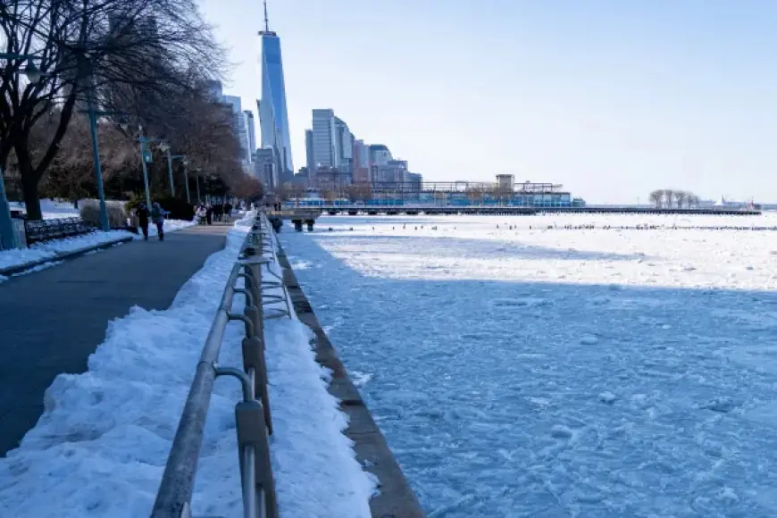
New York City is in a sharp cold snap Sunday, with clear conditions and a bitter nighttime low that can turn ordinary errands into a risk for anyone underdressed or stuck outside for long stretches. The immediate headline is the temperature: conditions are hovering near 12°F this evening, with an overnight low near 11°F, and wind can make it feel colder.
The good news for commuters and anyone planning outdoor time is that the worst of the cold eases after tonight. A slow, steady warmup is expected through midweek, with daytime highs climbing into the upper 30s and low 40s.
Right now: clear, very cold, and drying out
Skies are clear in NYC, which helps visibility but also allows heat to radiate away quickly after sunset. That’s a key reason the city can feel brutally cold at night even when the day looks bright.
Tonight is the most concerning period for exposure risk. Even without a major storm, extreme cold can be dangerous for prolonged outdoor activity—especially for older adults, young children, unhoused New Yorkers, and anyone who can’t easily get indoors.
What’s driving the cold
This pattern looks like a classic winter setup: a cold air mass parked over the Northeast, clear skies, and enough breeze at times to add extra bite. In these conditions, the temperature alone doesn’t tell the whole story—wind and low humidity can make the cold feel harsher, dry out skin quickly, and increase the chance of cold-related illness for people outside too long.
The temperature trend is also important. When lows get into the low teens, sidewalks and roads can develop icy patches from leftover moisture, melted snow piles, or dripping gutters—even if nothing is falling from the sky.
7-day NYC outlook: highs rising into the 40s
Here’s the day-by-day temperature trend for the city (all times Eastern):
| Day | Forecast | High | Low |
|---|---|---|---|
| Sun, Feb. 8 | Sunny, breezy, quite cold | 24°F | 11°F |
| Mon, Feb. 9 | Sun with some clouds | 33°F | 22°F |
| Tue, Feb. 10 | Mostly cloudy | 37°F | 33°F |
| Wed, Feb. 11 | Partly sunny, breezy | 41°F | 31°F |
| Thu, Feb. 12 | Partly sunny | 40°F | 23°F |
| Fri, Feb. 13 | Mostly cloudy | 38°F | 22°F |
| Sat, Feb. 14 | Plenty of sunshine | 39°F | 29°F |
The takeaway: tonight is the coldest low of the stretch, while the midweek period brings the most comfortable afternoons, even if it’s still winter-chilly.
What to expect for the Monday commute
Monday’s forecast is notably less harsh than tonight, with a high near 33°F. That’s still cold, but it reduces the risk of rapid exposure problems compared with low-teens temperatures.
Clouds mixing in Monday can also help keep nighttime temperatures from dropping as dramatically, which is why the Monday night low is expected to be warmer than Sunday night’s. If you’re planning early-morning travel, the colder, darker hours are still when any slick spots are most likely.
Cold-weather impacts: what New Yorkers actually notice
Even without snow, this kind of cold tends to show up in a few practical ways:
-
Wind-chill discomfort on avenues, bridges, and open platforms
-
Dry air effects like cracked skin and irritated throats
-
Higher heating demand that can stress older buildings and reveal drafty apartments
-
Car issues, including weak batteries and slower starts after a very cold night
-
Hidden ice near curbs, shaded sidewalks, and building runoff areas
If you’re out late tonight or early Monday, covering hands and ears matters more than people think—those areas lose heat fast and are most vulnerable in a quick drop to the low teens.
The week ahead: improving afternoons, watch the next drop
NYC’s temperatures improve into the low 40s by Wednesday, which is often when the city feels “almost mild” compared with a weekend like this. But the pattern also suggests another dip in overnight lows later in the week, back into the low 20s—cold enough to refreeze wet spots and keep winter hazards in play.
In short: tonight is the cold punch, midweek is the relief, and late-week nights bring a reminder that winter isn’t done yet.
Sources consulted: National Weather Service, NOAA, AccuWeather