


Snow and Sleet Persist Amidst Bitter Cold Temperatures Today
Today, Lawton, Oklahoma, is experiencing a combination of snow and sleet, leading to challenging weather conditions. The day will be marked by breezy winds and high temperatures peaking in the low 10s Fahrenheit.
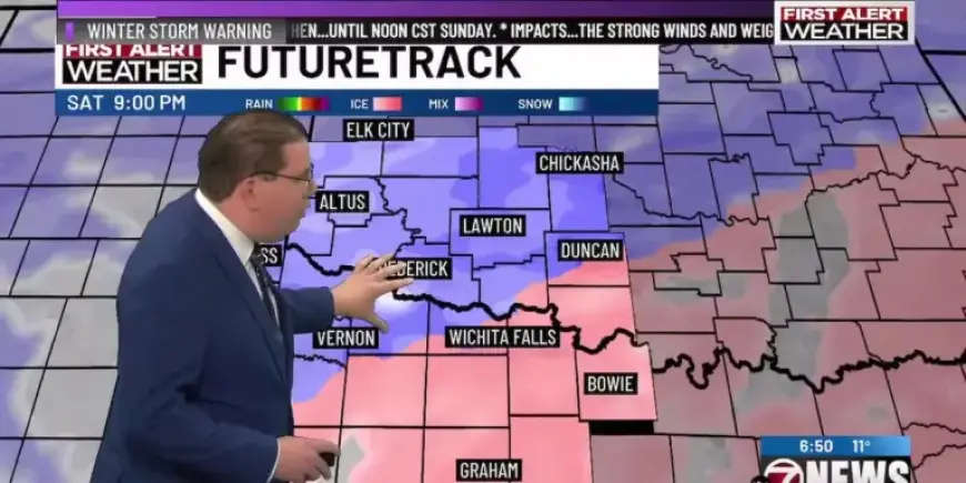
Upcoming Weather Forecast
This evening, the sleet and snow mix is expected to transition fully into snow as temperatures drop into the upper single digits. Residents should brace for scattered snow showers continuing into Sunday, with daytime temperatures hovering around 20 degrees.
Cold Snap Ahead
The forecast indicates that Sunday night will be particularly frigid. Clear skies will allow temperatures to fall slightly below zero, marking the coldest night of the season so far. Wind chills are predicted to plunge to dangerous levels, potentially reaching as low as -20 degrees.
Next Week’s Outlook
As Monday arrives, temperatures will remain below freezing, with a high in the low to mid 20s under partly cloudy skies. The following days, from Tuesday through Thursday, show a slight moderation in temperatures, with highs in the mid 30s, thanks to a mix of sun and clouds.
Scattered Snow Showers Possible
Looking towards the end of the week, scattered snow showers may return on Friday, with expected highs around 30 degrees. Residents are advised to stay informed about the changing weather patterns and prepare accordingly.
- Current Weather: Snow and sleet mixed
- Today’s High: Low 10s Fahrenheit
- Tonight’s Low: Upper single digits
- Coldest Night: Sunday night, slightly below zero
- Wind Chills: Could reach -20 degrees
- Monday’s High: Low to mid 20s
- Midweek Temperatures: Marginally above freezing in mid 30s
- Friday’s High: Around 30 degrees with possible snow showers
Stay updated with Filmogaz.com for the latest weather news and forecasts.