


DC Region’s Top Snowfall Areas Revealed
The recent snowstorm in the D.C. region brought impressive snowfall totals, ranging from 4.5 to 8.5 inches. Despite a swift transition to sleet, significant accumulations were observed across various neighborhoods.
Key Snowfall Measurements
According to the National Weather Service (NWS), multiple locations recorded notable snowfall. The measurements, taken by trained observers, are as follows:
- Virginia:
- Leesburg: 6.5 inches
- Ashburn: 6.1 inches
- Herndon: 6 inches
- Maryland:
- BWI Marshall Airport: 6 inches
- Bloomfield: 6.5 inches
- Adamstown: 6 inches
- Columbia: 6.7 inches
- Winchester: 6 inches
- Simpsonville: 8.5 inches (highest recorded)
- Savage: 7.5 inches
- Wheaton: 7 inches
- Brunswick: 7 inches
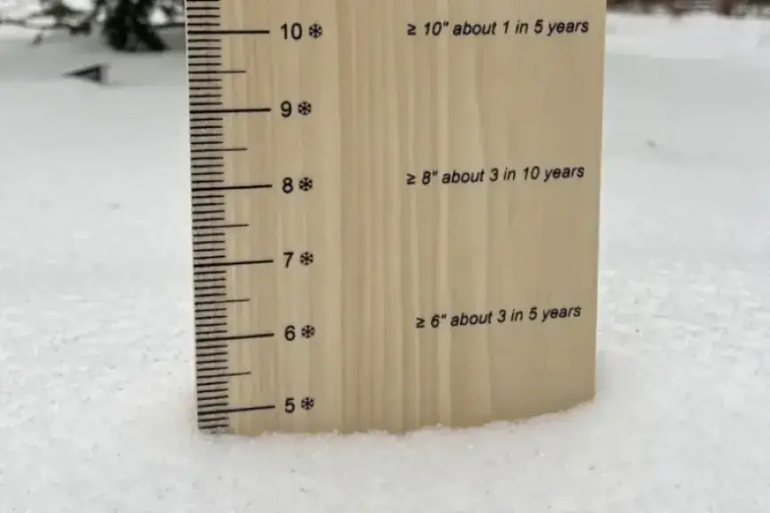
Measuring Snow and Sleet
Snowfall measurements are officially recorded every six hours at certified observation points. This method ensures accurate totals for each storm. Snow totals are distinct from snow depth, as they account for multiple observations throughout the day.
As of Sunday afternoon, sleet began to accumulate on top of the existing snow. While typical sleet is found in winter weather, prolonged periods of sleet are rare in the D.C. area. Meteorologist Matt Ritter indicated that conditions could yield up to two inches of sleet, compacting the snow below.
Historical Context
The most notable sleet event in recent history occurred on Valentine’s Day in 2007, when between 2 to 4 inches of sleet coated the region. Such occurrences highlight the unique winter weather patterns that can emerge in the D.C. area.
For more updates on weather conditions, visit Filmogaz.com.