


Freezing Rain and Ice Set to Hit North Georgia Tonight
The weather in North Georgia is set to take a dangerous turn as an ice storm approaches. This adverse weather is expected to impact the region significantly tonight, extending through Monday morning. Residents are advised to remain vigilant during this period, as hazardous travel conditions and the potential for power outages loom.
Ice Storm Warning Details
An ice storm warning is in effect for most of North Georgia, including metro Atlanta. Major cities included in this warning are:
- Atlanta
- Rome
- Ellijay
- Helen
- Blue Ridge
- Gainesville
- Stockbridge
- Jonesboro
- Athens
- Marietta
- Lawrenceville
- Decatur
- Sandy Springs
- Douglasville
- Conyers
- Covington
Expected Ice Accumulation
Ice accumulation is forecasted to range from 0.25 to 1 inch across the affected areas. North Georgia, particularly areas along I-85, may see higher deposits of ice. Even a quarter-inch of ice can create significant travel hazards. Accumulations of half an inch or more could result in downed trees and power lines, particularly if combined with wind gusts reaching up to 30 mph.
Winter Weather Advisory
A winter weather advisory has been issued for areas south of the ice storm warning. Primary locations impacted by this advisory include:
- Carrollton
- Newnan
- Peachtree City
- Griffin
- Eatonton
This advisory indicates that while some icy conditions may occur, they are not expected to be as severe as in the areas affected by the ice storm warning.
Timing of Weather Events
Residents should prepare for the following weather timeline:
- This Morning: Snow begins in northwest Georgia around 8 a.m.
- This Afternoon: A mix of rain and freezing rain develops in the north Georgia mountains.
- Tonight: Freezing rain will spread into metro Atlanta by 10 p.m.
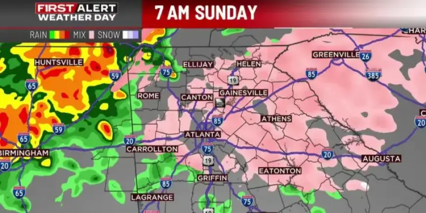
- Sunday Morning: Most of North Georgia, including metro Atlanta, will experience freezing rain.
- Sunday Afternoon: Transition to rain for much of North Georgia, with continued freezing rain in the northeast.
- Sunday Night: All precipitation moves out with roads likely to refreeze.
- Monday Morning: Conditions will be dry, but ice on the roads is expected due to refreezing.
Residents are urged to exercise caution and stay updated through local forecasts as the weather develops. Travel is discouraged during peak impact times to ensure safety.