


Philadelphia Braces for Snow and Ice in Weekend Weather Forecast
Philadelphia is preparing for significant snowfall and freezing rain this weekend, potentially surpassing what the city saw throughout the entire winter of 2024-25. The National Weather Service has issued a winter storm warning, effective from 7 p.m. Saturday until 1 p.m. Monday. Forecasts predict 8 to 12 inches of snow and up to a quarter-inch of freezing rain, heightening the risk of power outages.
Emergency Declarations and Preparations
In response to the impending weather, Philadelphia Mayor Cherelle L. Parker, along with Pennsylvania Governor Josh Shapiro and New Jersey Governor Mikie Sherrill, declared a state of emergency for Sunday. State officials have imposed speed restrictions, and concerns are mounting within public transportation systems, including SEPTA, about disruptions. Schools are also preparing for potential multi-day closures due to the harsh conditions.
- Winter storm warning: 7 p.m. Saturday to 1 p.m. Monday
- Potential snowfall: 8 to 12 inches
- Freezing rain accumulation: up to a quarter-inch
- Emergency declared by: Mayor Parker, Gov. Shapiro, Gov. Sherrill
Forecast Details and Impacts
This weekend’s storm is expected to bring harsh cold, with wind chills dropping below zero on Saturday morning. Sunday’s maximum temperature may reach only 25 degrees, making it the warmest day predicted for the week. Accumulating layers of snow and ice may solidify, lingering well into the coming weeks.
Timing and Accumulation
While the official storm warning begins at 7 p.m. Saturday, snow may begin to fall by Sunday morning. Rapid accumulation is likely, particularly in the early hours, with temperatures in the teens. Some reports suggest that sleet might mix with snow during the day.
| Time | Weather |
|---|---|
| Saturday Evening | Snow begins after warning in effect |
| Sunday Morning | Rapid snow accumulation expected |
| Sunday Afternoon | Possible sleet mix |
Regional Considerations
Current modeling indicates varying storm impacts across the region. Specific forecasts suggest that areas west of Philadelphia may receive higher snowfall amounts due to reduced ice projections. The overall concern for ice remains high, as freezing rain poses a greater risk to power infrastructure.
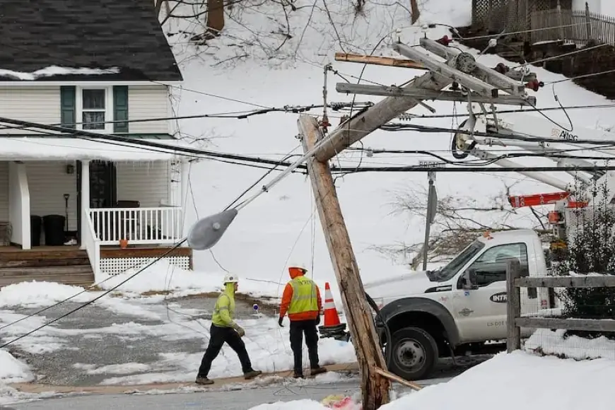
Power Outage Risks
The prediction of a quarter-inch of freezing rain raises alarms for utilities like Peco, which has crews on standby. Historically, ice storms have led to widespread outages, as seen in 2014 when over 700,000 customers were affected.
Long-Term Outlook
Looking ahead, temperatures in the Philadelphia area may remain below freezing, with no immediate thaw in sight. The National Oceanic and Atmospheric Administration suggests a continuing trend of below-normal temperatures through early February. There’s also speculation about another storm forming around Groundhog Day.
Residents should stay informed and prepare for a challenging weather weekend ahead.