


Capital Weather Gang DC weather: Washington, DC snow forecast points to a weekend storm—so how much snow are we getting?
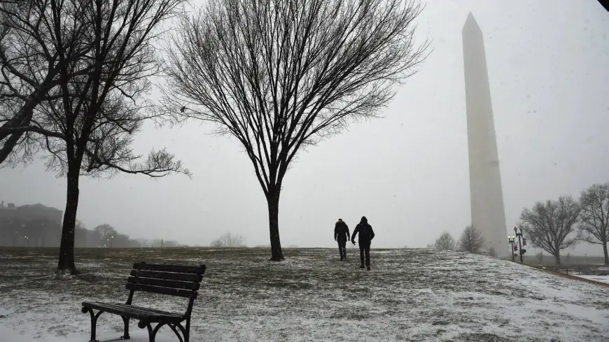
Washington, DC is lining up for its first widespread snow event of 2026 this weekend, with snow expected to break out late Saturday and intensify on Sunday. The big question—how much snow are we getting—still hinges on the storm track and whether parts of the region mix with sleet or freezing rain. As of Thursday, January 22, the most consistent signal favors a plowable snowfall for the District, with higher totals possible north and west and a lower-snow/ice risk increasing south and east.
The Capital Weather Gang has been framing this as a high-impact setup because the cold air is real, the moisture looks substantial, and timing puts the worst conditions on Sunday when travel and errands are typically busiest.
Capital Weather Gang: why this DC weather setup has forecasters focused
This storm has the ingredients that make Mid-Atlantic winter systems both disruptive and tricky: a deep shot of Arctic air arriving first, then a moisture-rich system pushing in over the top of it. That “cold air locked in” pattern increases the odds of accumulating snow, but it also creates a sharp gradient—meaning totals can change dramatically over short distances depending on where the heaviest bands set up and where any mixing line stalls.
-
Snow is most likely to begin late Saturday and ramp up early Sunday.
-
The District has the best chance at a meaningful accumulation Sunday, with bitter cold limiting melting.
-
North and west suburbs carry higher upside for bigger totals; south and east carry higher risk of mixing that cuts snow totals.
-
The cold behind the storm looks intense, so any untreated surfaces can stay icy well after snowfall ends.
-
Confidence is higher on “disruption” than on the exact inch count—final totals depend on band placement and precipitation type.
How much snow are we getting in DC?
For the District itself, the current baseline expectation is a few inches, with a realistic working range of about 3 to 6 inches for many neighborhoods if the storm stays predominantly snow. There is still a pathway to higher totals if a heavy band parks over the city for several hours on Sunday, and there is also a pathway to lower totals if sleet mixes in longer than expected.
A practical way to read it right now:
-
Washington, DC (most areas): likely 2–5 inches, with 3–6 inches still very much in play if snow stays dominant.
-
North and west (higher elevations / farther inland): higher odds of 6+ inches, with localized heavier pockets if banding sets up.
-
South and east (closer to the mixing threat): lower snow totals are possible if sleet/freezing rain intrudes, trading inches of snow for icing risk.
In other words: the “how much snow” answer is trending upward from nuisance to disruptive, but the ceiling depends on whether the storm remains a clean snow producer for the District.
DC snow forecast timeline: when it starts, peaks, and ends
Expect a weekend that changes fast:
Saturday (Jan 24): Clouds thicken and temperatures stay frigid. Snow may start later in the day, with roads deteriorating into the evening as accumulation begins.
Overnight Saturday into early Sunday: Snow coverage expands. If the storm evolves as expected, this is when intensity begins to build.
Sunday (Jan 25): The highest-impact window. Periods of steady to heavy snow are possible, and the cold will help accumulation stick on roads. Travel could become extremely difficult, especially during any heavier bursts.
Sunday night into early Monday: Snow tapers, but the cold remains. Refreeze becomes a major concern where roads were treated lightly or where slush gets compacted.
What could change the forecast fast
Two things can still swing totals noticeably:
1) Band placement. A single persistent band can add several inches to one area while leaving another underwhelming. The District sits right in the zone where this matters.
2) Mixing line. Even brief sleet can compact snow, reduce totals, and make roads worse. If freezing rain pushes farther north, the “snow total” headline drops—but the hazard level can rise.
A short historical reminder helps: DC storms that arrive with entrenched cold often overperform on accumulation, while storms that introduce sleet mid-event often underperform on snow totals but overdeliver on travel impacts.
What to watch next before you lock in plans
The clearest signals over the next 24–36 hours will be (a) whether winter storm headlines are upgraded from advisories to warnings, (b) where the forecast places the heaviest snow axis for Sunday, and (c) whether the mixing threat grows or shrinks. If the cold air holds firm and the storm track stays favorable, the District’s snow totals edge higher; if sleet pushes in sooner, totals flatten while icing risks increase.
For now, the most reasonable expectation is a disruptive Sunday snow in Washington, DC—enough to slow travel, complicate schedules, and keep roads slick into Monday—while the exact “how much snow are we getting” number remains the last piece that will sharpen as the storm gets closer.


