


Winter Storm Watch for North and Central Texas: Dallas Weather Braces for Ice Storm and Snow This Weekend in January 2026
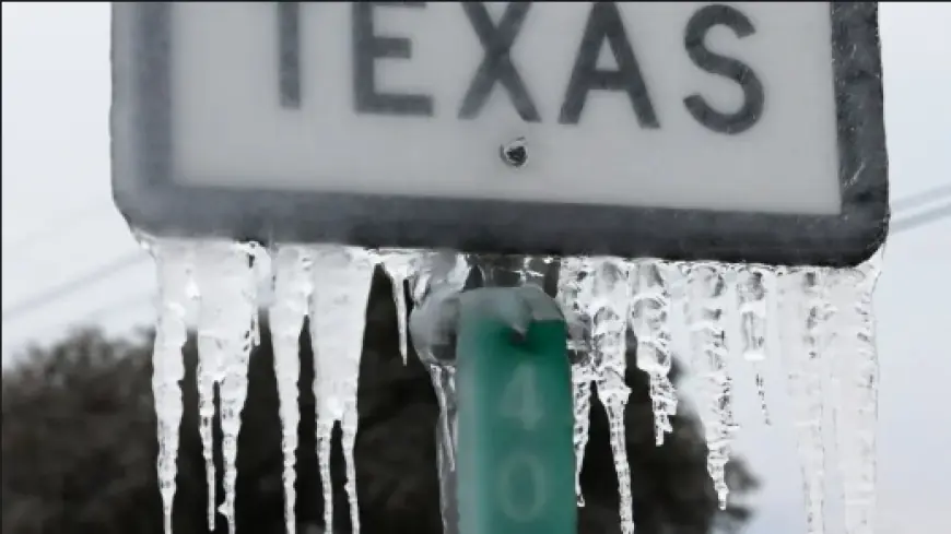
A Winter Storm Watch is now up for a broad slice of North and Central Texas as a sharp temperature plunge sets the stage for a high-impact winter storm this weekend. The setup is classic for dangerous travel: mild air and rain first, then a fast drop below freezing while precipitation is still falling—turning roads into a mix of slick ice, sleet, and pockets of snow.
For anyone searching “winter storm,” “snow this weekend,” or “snow storm coming,” the key message is the same: the biggest risk in this event isn’t deep snow totals—it’s ice and rapid freezing on bridges, overpasses, and untreated roads, especially Friday night into Saturday.
Winter Storm Watch timing and why this weekend is a higher-risk window
The Winter Storm Watch covers the period from midday Friday, January 23, 2026, through early Sunday morning, January 25, 2026 in parts of North and Central Texas. A watch means significant winter weather is possible, and the forecast confidence is high enough to begin preparations—while exact amounts and the rain-versus-ice line still need refinement.
The main hazards expected during the watch window:
-
Freezing rain and sleet creating a glaze on roads, trees, and power lines
-
Rapid temperature drops causing wet roads to freeze quickly
-
Short bursts of snow or sleet reducing visibility and traction
-
Power outage potential where ice accretes and winds increase
Dallas weather: snow forecast and ice storm risk this weekend
Dallas weather turns from damp to dangerous fast late Friday. Rain remains the main story early, then cold air undercuts the system and changes precipitation type.
Dallas area trend (high-level forecast):
-
Wednesday, Jan 21: Cloudy with a passing shower, then some sun; high near 63°F / low near 43°F
-
Thursday, Jan 22: Mostly cloudy; high near 59°F / low near 43°F
-
Friday, Jan 23: Periods of rain, turning sharply colder; high near 47°F / low near 22°F
-
Saturday, Jan 24: Very cold with sleet and freezing rain, with some snow late; high near 26°F / low near 12°F
-
Sunday, Jan 25: A bit of snow/sleet early, then very cold; high near 24°F / low near 15°F
This is the kind of snow storm weather forecast that produces major problems even if snow totals stay modest—because ice forms first, then any snow that falls can hide the glaze underneath.
San Antonio weather: rain changing to ice, then lingering slick spots
Farther south, San Antonio weather looks warmer at the start, but the weekend changeover still brings an ice threat as the cold air arrives.
San Antonio area trend (high-level forecast):
-
Wednesday, Jan 21: Brief morning showers, warmer later; high near 74°F / low near 53°F
-
Thursday, Jan 22: Mostly cloudy; high near 73°F / low near 61°F
-
Friday, Jan 23: Periods of rain, breezy; high near 69°F / low near 35°F
-
Saturday, Jan 24: Rain changing to ice, very cold; high near 37°F / low near 20°F
-
Sunday, Jan 25: A little ice mixing with rain early; high near 38°F / low near 22°F
For the I-35 corridor, small shifts in temperature—just a couple degrees—can mean the difference between cold rain and a thin ice layer that shuts down travel.
Winter storm this weekend: what “Winter Storm Fern” means (and what it doesn’t)
Some private forecasts and social-media weather posts are calling this system “Winter Storm Fern.” That label is unofficial and not an agency designation, but it’s being used as shorthand for the same late-week storm bringing the watch-level threat. Whether you call it a winter storm this weekend or “Fern,” the impacts in Texas hinge on two variables: how quickly surface temperatures fall below freezing, and where the heaviest precipitation band sets up during that drop.
Weather this week: the practical checklist before the worst arrives
If you’re in the watch area, treat Thursday as the last easy day to prepare.
Priority actions:
-
Finish errands early; avoid “just one more trip” once temperatures approach freezing Friday night
-
Charge devices and set aside flashlights and backup batteries
-
Protect pipes (wrap exposed lines, drip faucets if hard freeze arrives)
-
Plan for power interruptions where icing is most likely
-
If you must drive, assume bridges and overpasses freeze first and stay icy longer
10 day forecast outlook: when it improves after the storm
The cold lingers into early next week, then a gradual rebound begins.
-
Dallas trends back toward the 40s by Tuesday and near 50 by midweek, with sunnier skies after Monday.
-
San Antonio climbs into the 50s by Tuesday and around 60 by Wednesday, with improvement after the weekend’s early slick spots.
The bottom line for this weather forecast: the most disruptive window looks centered on Friday night through Saturday, with lingering icy patches possible into Sunday morning—especially in shaded areas and on elevated roadways.


