


Ontario Braces for Heavy Snowfall and Incoming Polar Vortex Cold
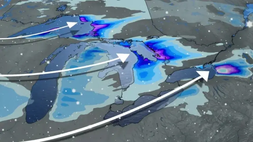
Ontario is preparing for a significant winter storm as a Prairie clipper approaches the region. From Wednesday into Thursday morning, widespread snowfall is expected, impacting major areas including the Greater Toronto Area (GTA), Ottawa, Windsor, and Niagara.
Forecasted Snowfall Amounts
Snow accumulation is projected to reach:
- 5-10 cm: GTA, Ottawa, Windsor, Niagara.
- 10-15+ cm: Near London, snow belts, and along Lake Erie and Ontario shores.
Blowing snow may also significantly reduce visibility as wind gusts are projected to reach 50-60 km/h. Drivers are cautioned to prepare for potentially difficult travel conditions.
Impending Cold Snap
Following the snowfall, a wave of frigid Arctic air is set to intensify over the weekend. Daytime temperatures across much of Ontario will likely remain in the minus teens on Saturday. This cold spell is expected to persist, with temperatures staying below seasonal averages until the end of January.
Expected Low Temperatures
Cities could experience the coldest temperatures in years:
- Ottawa: Possible lows of -21°C, marking the coldest day in a decade.
- Northern Ontario: Areas may dip close to -40°C.
- Northeastern Ontario: Widespread overnight lows nearing -30°C.
This extreme cold snap highlights the harsh winter conditions Ontario faces, aligning with the effects of the incoming polar vortex. Residents should take necessary precautions to stay safe and warm during this intense winter period.