


Winter Storm Watch Issued; Blizzard Warning May Follow
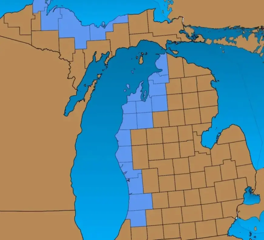
A Winter Storm Watch has been issued for several counties in Michigan, signaling potential blizzard conditions. This advisory is in effect from Sunday afternoon through Monday evening, specifically along the Lake Michigan border and in the Marquette area.
Winter Storm Watch Details
The Winter Storm Watch encompasses the following regions:
- Lake Michigan border counties
- Traverse City area
- Marquette region
Snowfall is expected to begin Sunday afternoon and continue into Monday, with accumulations of four to six inches possible. Wind speeds will increase as well, with gusts reaching up to 40 mph on Monday morning.
Blizzard Conditions Forecast
Blizzard conditions may develop due to the combination of dry, fluffy snow and strong winds. Key factors include:
- Wind gusts over 35 mph
- Visibility reduced to less than one-quarter mile
- Duration of blizzard conditions lasting three hours or more
The National Weather Service (NWS) has indicated that while there is no Blizzard Watch currently in effect, the existing Winter Storm Watch could escalate to a Blizzard Warning. This upgrade typically occurs just hours before blizzard conditions take hold.
Safety Precautions
The NWS emphasizes the importance of taking precautions. If a Blizzard Warning is issued for your area, it is advised to avoid driving unless absolutely necessary.
Stay informed of the latest updates by visiting Filmogaz.com, where we will continue to provide timely weather information.