


Severe Storms Threaten Millions with Tornadoes and Flash Floods This Weekend
Millions across the central and eastern United States face a period of volatile weather this weekend. Forecasters warn of tornadoes, heavy rain and flash floods as a strong system moves through the region.
Scope of the Threat
The Storm Prediction Center says about 38 million people from North Texas to Michigan are at risk for severe weather on Friday. The highest tornado probability covers Iowa, Wisconsin and northern Illinois.
Roughly 12 million more people in the Ohio Valley and eastern Great Lakes could see severe thunderstorms. The Upper Mississippi Valley was identified as having the best chance for strong tornadoes.
Cities in the Danger Zone
- Tulsa
- Wichita
- Madison
- Milwaukee
- Chicago
- Kansas City
- Oklahoma City
- Des Moines
- St. Louis
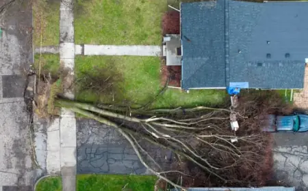
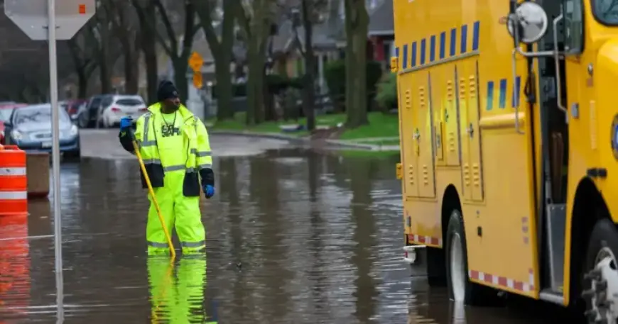
Local Impacts and Early Damage
Persistent storms have already produced record flooding in parts of Wisconsin. Floodwaters stranded drivers on Milwaukee highways after intense rain midweek.
State health officials report communities are starting cleanup. They urged caution when assessing damage and removing debris because more severe weather is expected.
Witness Reports
A resident in Stewartville, Minnesota posted video that appeared to show a tornado near her workplace on Friday. Agencies say the threat will expand as storms intensify into the evening.
What Hazards to Expect
Forecasters expect a significant damaging wind threat from the Lower Missouri Valley into the Middle Mississippi Valley. Hail risk is highest across parts of the central and southern Plains.
Abundant moisture and an approaching upper-level trough could produce hourly rainfall rates of one to two inches. That raises the odds for flash floods in many areas.
Fire Weather and Temperatures
The National Weather Service’s Washington/Baltimore office issued a Red Flag Warning for parts of Virginia’s eastern panhandle and the I-81 corridor. Low humidity, dry fuels, near-record heat and gusts up to 25 mph drove the alert.
Temperatures will stay well above normal through Friday. Forecasts call for 70s and 80s across the Midwest and highs in the 80s to low 90s in the Southwest before a cooling front arrives.
Filmogaz.com will continue to monitor conditions as this system evolves. Stay tuned for updates and heed local warnings if you live in affected counties.