


Approaching First Alert Days: Prepare for Upcoming Weather Changes
Scattered showers and a few thunderstorms moved into southwestern Wisconsin late Sunday. The overall severe threat remained low, but pockets of heavy rain were possible.
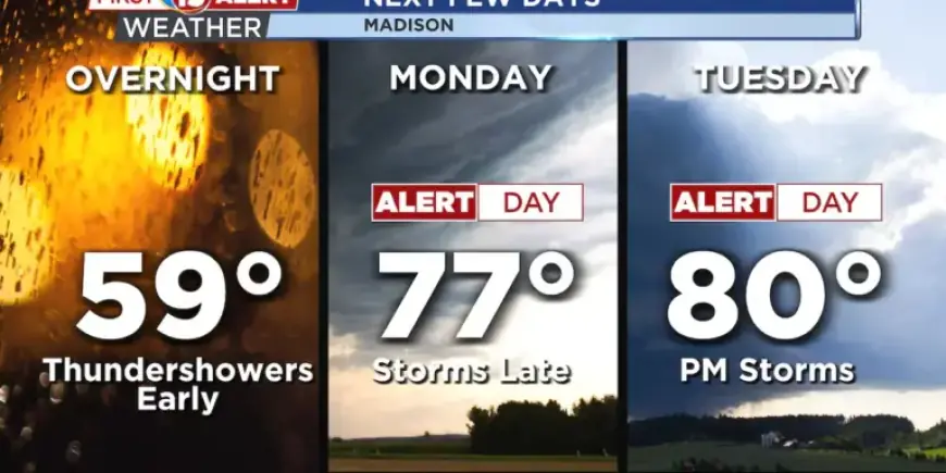
Overview and timing
Monday has been designated a First Alert Day for the area. A warm front will serve as the trigger for late-afternoon and evening storms. The front is expected to settle just north of the I-90 corridor, so locations along and north of that line carry the greatest risk.
Where and when to watch
Storm development will focus along the warm front during the late afternoon and evening. South of the boundary, temperatures should reach the mid to upper 70s. Southerly winds will continue to funnel warm, moist air into the region.
Main hazards
Hail is the chief concern with storms that form. Large to very large hail is possible, with sizes up to two inches reported in stronger cells.
Tornado and wind potential
There is a brief window for tornadoes as cells initially form. That tornado risk will diminish as storms grow and merge. Wind-driven severe storms appear less likely than damaging hail.
Tuesday outlook
Forecasters have also tagged Tuesday as a First Alert Day in parts of the region. The severe threat should become more confined to far southwestern Wisconsin and adjacent counties by afternoon. Moisture from Monday’s activity may shift southeast, reducing overall storm coverage.
Extended forecast
Additional rounds of showers and thunderstorms are possible on Wednesday, Thursday and Friday. Both Wednesday and Friday carry some risk for strong to severe storms. Confidence in the exact timing lessens later in the week.
Temperature trend
Expect a warm stretch through Friday. Highs should return to the 70s and near 80 in southern Wisconsin. A cold front arrives Saturday and will drop highs into the 50s by next weekend.
Rainfall and flooding concerns
An active pattern means multiple rounds of rain are likely. Widespread totals of one to two inches are expected through Wednesday. Localized amounts could exceed that where storms train repeatedly or produce heavy rates.
The ground is already saturated from recent rains. Minor flooding remains a concern, especially with stronger storms. Rivers may rise, and some reaches could approach flood stage.
Preparation advice
As First Alert Days approach, residents should monitor forecasts and prepare. Keep a battery-powered radio, charge phones, and secure outdoor items. Have an action plan in case severe weather or flooding develops.
Filmogaz.com will continue to update the forecast and alert readers to any changes. Stay tuned to local warnings and be ready to take shelter if conditions warrant.