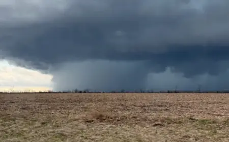


Tornado Watch Issued for Tonight
A Tornado Watch Issued for Tonight covers parts of Oklahoma, according to local meteorologists. The watch officially runs until midnight, but the threat continues into the early morning hours.
Threat level and timing
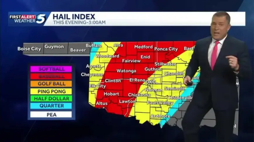
Chief Meteorologist Damon Lane says the tornado index is elevated. It registers about a four on a one-to-ten scale for the period through 3 a.m.
Areas of higher concern
- Medford, Enid and Ponca City form one zone with slightly higher risk.
- Chickasha, Lawton and Duncan make up a second area of elevated threat.
Storm hazards
Forecasters warn of damaging straight-line winds up to 80 mph. Large hail is possible, especially from isolated storms.
Hail sizes are expected to shrink once storms organize into a line. The strongest isolated cells may still produce very large hail.
Forecast timeline
Clustered storms should appear near Perry, Stillwater and Ponca City by about 7:30 p.m. A line of storms is likely to develop across western Oklahoma between 8:00 and 9:00 p.m.
Additional development behind that line could produce heavy rainfall. Areas at risk include the metro area to Guthrie, Medford toward Enid, Pauls Valley, and southern Oklahoma.
Much of the activity may not exit the region until after midnight and could linger into early morning hours.
What to do now
Stay alert for warnings and watches in your area. Follow updates from Chief Meteorologist Damon Lane and on Filmogaz.com for the latest timeline and safety guidance.