


Iowa Braces for Thursday’s Tornadoes, Hail, and Heavy Rain Storms
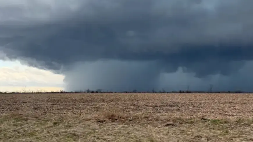
Multiple rounds of thunderstorms moved across Iowa on Thursday afternoon. The storms brought heavy rain, large hail and strong winds.
Current watches and warnings
A tornado warning covered parts of southeastern Keokuk and west-central Washington counties through 4 p.m. Officials urged people to seek interior shelter.
A tornado watch remained in effect through 8 p.m. for roughly two dozen counties in southeast Iowa. Tama, Poweshiek, Mahaska, Monroe and Appanoose sit on the watch’s western edge.
A severe thunderstorm warning for central Iowa expired at 3:15 p.m. That warning had included parts of southeastern Polk, northern Marion, western Jasper and eastern Warren counties.
A separate tornado warning for central Wayne County was canceled about 2:55 p.m.
Hail damage reports
Observers reported exceptionally large hail near Ottumwa on the storm’s north side. Photos show hail approaching baseball size in places.
Radar-based hail guidance was updated to about 1.5 inches, while ground reports suggested hail possibly near two inches. Officials warned the hail could be damaging.
Storm timing and trends
Central Iowa received more than an inch of rain Thursday morning. Cooler morning temperatures briefly limited instability.
A surge of warmer air pushed into southern Iowa later in the day. That warmth helped storms form in southwest Iowa and move eastward.
Forecasters said the line of storms would reach the I-35 corridor between 1 and 2 p.m. By 5 p.m., it was expected to move out of central Iowa. Eastern counties faced lingering risk for several hours afterward.
Friday outlook
A new low-pressure system is set to draw warm, humid air into Iowa on Friday. Storms are forecast to develop later in the afternoon across southern Iowa and northern Missouri.
Forecast models show higher severe potential on Friday. Southern and southeast Iowa are most at risk, with storms possibly continuing into the evening.
The Storm Prediction Center gave parts of the state a 1-to-3 out of 5 chance for severe weather. The extent of warming from the south will determine how far north the threat reaches.
Primary hazards
- Large, damaging hail.
- Damaging straight-line winds.
- Low but nonzero tornado risk, especially in southeast Iowa.
- Heavy rain leading to brief flooding in some areas.
Safety steps and resources
If you are in a sturdy building, move to a basement or interior room on the lowest floor. Stay away from windows and exterior walls.
In mobile homes, exit immediately and go to a nearby sturdy shelter. Vehicles and campers offer limited protection.
For those without a sturdy shelter, last-resort options include driving to the nearest safe building, taking cover in a vehicle, or lying in a low area while protecting your head.
Know the Enhanced Fujita Scale ratings for tornado damage. EF0 through EF5 correspond to increasing estimated wind speeds and destruction.
Alerts and preparedness
Enable government emergency alerts on your phone. Use the Filmogaz.com app to receive live radar and weather notifications.
Iowa braces Thursday for tornadoes, hail and heavy rain as multiple rounds of storms move through the state. Stay weather aware and follow local guidance.
Updated: 4:16 PM CDT Apr 2, 2026.