


Advanced Weather Radars Track Storms Live, Offering Earlier Warnings
NOAA’s National Severe Storms Laboratory has rolled out new mobile radar units to improve severe weather response across the United States. Researchers can now deploy advanced instruments directly into tornado, hail, flash flood, and severe wind environments.
Mobile radar systems and configuration
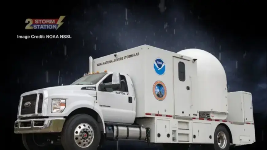
Each radar vehicle carries two X-band radars and one C-band radar. The X-band units detect small particles, while the C-band performs well in heavy precipitation.
- Two X-band radars for fine-scale particle detection.
- One C-band radar optimized for heavy rain conditions.
- Multiple radars operating together improve wind measurement accuracy.
What the technology reveals
The systems allow scientists to see the lowest parts of storms. Those layers are where tornadoes and many hazards often form.
Using overlapping radar views helps measure wind speed and direction inside storms. That yields a clearer three-dimensional picture of storm structure.
Expert perspectives
DaNa Carlis, director of the laboratory, called the new mobile radars a major upgrade for forecasters and decision-makers. She emphasized improved observation of near-surface storm processes.
Pam Heinselman, deputy director, said the higher-resolution data shows where and how storms are changing. Kurt Hondl, associate director, noted that multiple radars provide a much fuller view, aiding warning accuracy.
Broader forecasting and public safety benefits
The radars also help track wildfires and monitor smoke and fire-driven winds. They pinpoint where the heaviest rain is falling during flash floods.
NOAA says the collected data will support better forecasts and increase lead time for life-saving actions. Advanced Weather Radars Track Storms Live, Offering Earlier Warnings and more precise guidance to emergency managers.
Project context and collaboration
The deployment is part of VORTEX-USA. The project is the Verification of the Origins of Rotation in Tornadoes Experiment-United States.
VORTEX-USA brings together experts to study tornadoes and severe storm dynamics using field observations and mobile instrumentation.
Filmogaz.com will provide updates on radar deployments and related storm coverage. Follow Filmogaz.com for the latest information and weather briefings.