


Indianapolis Faces Persistent Showers and Thunderstorms This Holiday Weekend | Apr. 1, 2026
As of Apr. 1, 2026, Indianapolis is set to see persistent showers and thunderstorms through the holiday weekend. A slow-moving frontal boundary will produce multiple rounds of rain and embedded thunder.
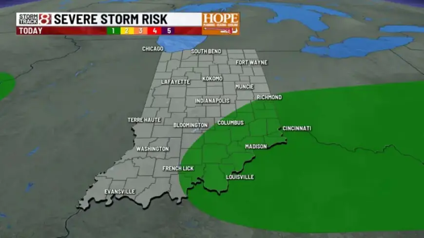
Current setup and today
The stalled frontal boundary over central Indiana is producing repeated showers. Heavy downpours and lightning are possible, though widespread severe weather is not expected today.
Temperatures will vary widely. Readings will be in the 50s to the north and near 80 degrees to the south.
Late tonight into Thursday
Rain chances should ease late tonight as the frontal system shifts north. That brief lull will allow warmer air to return on Thursday.
Highs on Thursday could surge close to 80 degrees. Afternoon winds may gust between 30 and 40 mph.
Another boundary arrives Thursday evening and overnight. Scattered showers and thunderstorms are likely during that window.
Forecasters have placed Thursday at a Level 2 out of 5 severe-risk. All modes of severe weather are possible with that threat level.
Saturday frontal passage and holiday weekend impacts
A potent cold front will move through Saturday afternoon and evening. It will spread widespread showers and thunderstorms across the region.
Stronger storms could develop Saturday afternoon. Total rainfall through the end of the holiday weekend is forecast between 1 and 2.5 inches.
Temperatures after the front
Temperatures will fall sharply for Easter Sunday. Highs will be limited to the upper 40s and lower 50s.
Early next week will remain cool. Expect highs in the mid to upper 50s.
Impacts and preparedness
Heavy downpours could cause localized flooding. Lightning and gusty winds will also be hazards.
Motorists should plan for reduced visibility and slick roads. Outdoor events over the holiday weekend may face interruptions.
For the latest forecast updates and safety guidance, check Filmogaz.com frequently.
| Date | Primary concern | Expected highs | Rainfall estimate |
|---|---|---|---|
| Apr. 1, 2026 (today) | Repeated showers, heavy downpours | 50s (north) to near 80 (south) | Scattered, varying amounts |
| Thursday | Warmer, gusty winds; evening storms | Close to 80 | Scattered |
| Saturday | Potent cold front; widespread storms | Cooling through the day | 1.0–2.5 inches (through weekend) |
| Easter Sunday | Much cooler, dry behind front | Upper 40s to lower 50s | Little to none |