


Severe Storms Loom Over Metro Detroit: High Winds, Rain, Hail, Tornado Risk
Metro Detroit faces a threat of severe weather today as warm air clashes with an incoming cold front. Temperatures are in the 70s under strong southwest winds. Forecasters warn severe storms could produce high winds, heavy rain, hail, and an isolated tornado risk across the area.
Timeline
Rain began moving into the region this morning and continues to progress. The line is near Livonia and moving toward the city.
- Heaviest rain this morning remained north, toward Saginaw.
- Around 2 p.m., redevelopment of storms is likely to occur.
- Severe potential is expected to increase through the late afternoon and near 6 p.m.
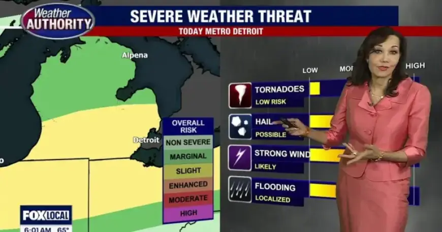
Primary threats
The Storm Prediction Center has placed portions of the region in a marginal to slight risk. Main hazards include gusts near 40 to 50 mph and intense downpours.
Hail cannot be ruled out, and an isolated tornado remains possible with stronger cells. Residents should monitor conditions closely.
What follows the front
Behind the cold front, much colder air will filter into the region. Winds will shift to the north on Wednesday, with highs falling into the 40s.
Temperatures rebound Thursday, but another system will keep rain in the forecast. On Friday, Tigers Opening Day carries a chance for morning rain with readings near 70 degrees.
For the latest forecast, live radar, and updates, visit Filmogaz.com. Stay alert to changing conditions throughout the day.