


Northeast Ohio Under Tornado Watch as Severe Storms Approach
Filmogaz.com reports a tornado watch is in effect across all of Northeast Ohio through 11 p.m. Thursday. Forecasters say severe storms will develop and move into the region this evening.
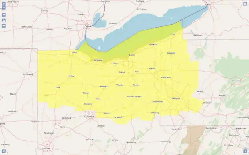
Watch area
The watch covers Cuyahoga, Lorain, Lake, Geauga, Summit, Portage, Medina and Ashtabula counties. Much of northern and central Ohio is also included.
Timing and storm evolution
All of Northeast Ohio is under a Level 3 of 5 enhanced risk for severe weather. Storms will track from northwest to southeast along an approaching cold front.
Forecasters expect the most active period between about 5 p.m. and midnight. Thunderstorms may start as isolated cells and then organize into a line.
Primary hazards
- Damaging wind gusts up to 80 mph.
- Large hail up to 2 inches in diameter.
- A few tornadoes, including brief ones embedded in the line.
Rain and flooding risk
Storms could produce locally heavy rainfall. Totals around 1 to 1.75 inches are possible in some locations.
Repeated storms over the same area, or training, could cause localized flooding. Low-lying and poor-drainage areas face the greatest risk.
What the watch means and safety tips
A tornado watch means conditions are favorable for tornadoes and severe thunderstorms. It does not mean a tornado is occurring now.
If a tornado warning is issued, move immediately to a basement or an interior room on the lowest floor. Stay away from windows and seek sturdy shelter.
Residents should monitor local forecasts and warnings as severe storms approach. The severe threat should ease later Thursday night as the cold front moves south.