


Earthquake Rattles Sleepy Hollow and Westchester County Just 25 Miles from NYC Tuesday Morning
A magnitude 2.3 earthquake shook Westchester County, New York this morning, sending hundreds of residents scrambling to social media to report a jarring jolt that felt more like an explosion than a typical tremor. No injuries or structural damage have been reported.
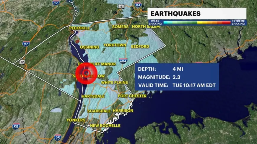
What Happened and Where
The quake struck in Sleepy Hollow, N.Y., at approximately 10:15 a.m. ET Tuesday, according to the U.S. Geological Survey. It hit about 4.5 miles below ground — a shallow depth that amplifies surface shaking — and Sleepy Hollow sits roughly 25 miles north of Midtown Manhattan.
More than 900 people filed reports with the USGS confirming they felt it. The volume of responses for a sub-3.0 event is notable, and reflects how efficiently the region's hard bedrock conducts seismic energy across a wide area.
"Felt More Explosive Than Typical"
The reaction on the ground was immediate. "Massive boom in New York, felt it strong just north of New York City in Westchester County," wrote journalist Brian Ries on X Tuesday morning. "Felt more explosive than typical subtle earthquake rumbling."
Others across the county echoed the same description — reports came in from Yonkers, New Rochelle, and White Plains, with one resident writing, "Whole building rumbled up here."
That boom-like quality is a well-documented feature of shallow East Coast quakes, not an anomaly. The dense, ancient bedrock beneath the Northeast transmits seismic waves with far less absorption than the fractured geology of California, making even modest events feel abrupt and loud.
The Fault Line Behind It
The Ramapo Fault — an active fault system running from Pennsylvania through New Jersey and into New York — is the most likely source. It generates a number of small earthquakes in the region each year.
The fault system dates to the construction of the Appalachian and Blue Ridge Mountains hundreds of millions of years ago. These ancient fractures are being periodically reactivated by stress derived from present-day rifting at the Mid-Atlantic Ridge. They are not going away.
Tuesday's event fits a familiar recent pattern. A magnitude 3.0 earthquake centered near Hasbrouck Heights, N.J. — about 10 miles from downtown Manhattan — rattled parts of New Jersey and New York State on August 2, 2025. Before that, a 4.8 magnitude earthquake struck near New York on the morning of April 5, 2024, at 10:23 a.m. ET — the strongest in the region in decades, felt from Philadelphia to Boston.
The Bigger Picture
Quakes below 3.0 magnitude are considered relatively weak on the Richter Scale, which runs from 1 to 9. Tuesday's event won't trigger emergency protocols or structural assessments. But it lands in a city where the vulnerability gap between what shakes and what breaks remains wide.
Most of New York City's buildings were constructed before a seismic code was put in place in 1995. Unreinforced masonry structures perform poorly in earthquakes, and taller buildings adjacent to shorter ones or vacant lots face elevated risk from lateral shaking.
A 2008 Columbia University study concluded the New York area faced "substantially greater" risk of a magnitude 6 or 7 earthquake than previously understood. Seismologists at the university's Lamont-Doherty Earth Observatory have long maintained that a magnitude 5.0 event — the threshold for real structural damage in the five boroughs — strikes the region roughly once every century. The last one hit in 1884.
The USGS has not issued any aftershock advisories following Tuesday's tremor.


