


Severe Thunderstorm Warning as March 4 storms swamp North Texas
Heavy thunderstorms moved through North Texas on the evening of March 4, prompting a severe thunderstorm warning and flash flood alerts that persisted into the early hours. The storms produced damaging hail, widespread flooding in parts of the Dallas area and prompted a statewide emergency declaration ahead of a potentially more dangerous period later in the week.
Severe Thunderstorm Warning for DFW
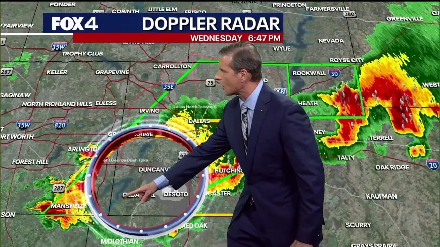
Severe thunderstorm watches and warnings covered the Dallas–Fort Worth region late on March 4. A severe thunderstorm watch was in effect until 12: 00 a. m. ET for numerous North Texas counties, while flash flood warnings were active overnight. Heavy rain stalled along a frontal boundary across the metro area, leaving roads flooded and stranding vehicles in several locations.
severe thunderstorm warning and flash floods
Flash flood warnings were in place into the overnight period: Van Zandt County was under a flash flood warning until 3: 00 a. m. ET, including life-threatening flooding for communities such as Canton and Wills Point. Dallas County’s flash flood warning continued through 2: 45 a. m. ET and included parts of Kaufman and Rockwall counties. In southwestern Dallas County, roughly 3–5 inches of rain had already fallen with an additional 2–3 inches expected, producing multiple water rescues and reports of cars stalled in high water.
State of emergency and outlook
State officials declared a state of emergency to let emergency management assist local governments ahead of expected storms later in the week. The pattern is expected to become more favorable for damaging storms on Friday, with the potential for more widespread severe weather and tornadoes. Damage surveys were scheduled for Friday to confirm tornado tracks and intensity where twisters were reported earlier in the week.
Other impacts across the central U. S. included multiple tornado touchdowns reported across Texas, Oklahoma and Kansas, two fatalities in Oklahoma after a vehicle was struck by a tornado, and large hail that dented vehicles and disrupted operations at the region’s main airport. In North Texas, heavy rain transformed a stretch of Interstate 45 south of Dallas into a swift-moving flood and left some homes in parts of the region under several feet of water; one community reported as much as 6. 52 inches of rain from the event.
Forecasters indicated a brief lull for North Texas on Thursday with highs climbing into the 80s before storms return Friday afternoon into the night. There is an increased risk of additional flooding by the second half of the weekend, with total rainfall across the metro area potentially reaching about 4 inches when all is said and done. Shower and thunderstorm chances were expected to persist into the following week, with a noted higher chance on March 10.
Key takeaways: heavy storms on March 4 brought life-threatening flash flooding overnight; emergency managers mobilized under a state declaration; and the weather pattern may produce more widespread severe storms on Friday, raising the risk of hail, tornadoes and additional flooding.