


Heavy Snow Warning as 20 Inches Set to Hit Wasatch Mountains
A winter storm watch issued early Wednesday morning could be upgraded to a heavy snow warning as a powerful system expected to dump up to 20 inches of snow arrives, bringing travel-disrupting conditions to mountain routes beginning early Thursday. The watch covers the Wasatch, Western Uinta and Central Mountains and remains in effect through Friday afternoon; heavy, travel-disrupting snow is expected to begin with a cold front passage Thursday morning.
Heavy Snow Warning Possible in Wasatch
Forecasters indicate at least a portion of the current watch area is likely to be upgraded to a winter storm warning later Wednesday, which would signal imminent high-impact snowfall. Upper Cottonwoods are forecast to receive the heaviest totals—up to 20 inches—with intense snow periods tied to a cold front followed by wraparound bands into Friday morning. Between 6 and 14 inches are expected elsewhere within the watch area.
Snow Totals and Expected Timing
A period of accumulating snowfall, heavy at times, is expected to accompany the cold front passage Thursday morning. A brief lull is likely Thursday afternoon before snow and wraparound showers redevelop late Thursday into Friday morning. Winter weather advisories already cover much of the region where up to 9 inches are set to fall across a widespread corridor beginning near St. George and stretching toward Salt Lake City.
| Area | Estimate |
|---|---|
| Upper Cottonwoods | up to 20 inches (approx. ) |
| Watch-area mountains (other) | 6–14 inches (approx. ) |
| Widespread corridor beginning near St. George | up to 9 inches (approx. ) |
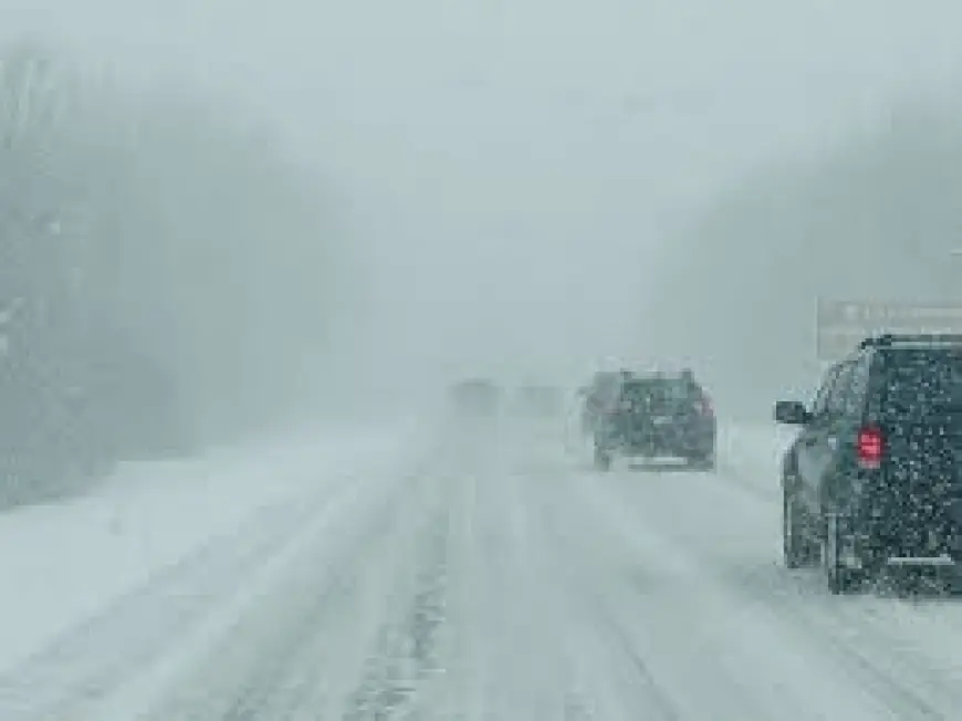
Travel and Avalanche Concerns
Mountain passes and routes such as Mirror Lake Highway, Logan Summit, Alta and Brighton face hazardous conditions where traction restrictions may be required. The watch warns of travel-disrupting snowfall that could make mountain routes difficult to pass. Avalanche danger is noted as an additional uncertainty in the mountains at this stage. A lull is expected Thursday afternoon, but drivers are advised to monitor local updates because snow is expected to redevelop overnight into Friday morning.
Elsewhere, a separate regional forecast shows a milder pattern on Thursday with breezy conditions before rain and snow showers arrive Friday. In that area, accumulations are expected to be minimal along and east of I-25, with a few inches possible at higher elevations such as Teller county and over the Palmer Divide. Snow is likely to stick to grassy and elevated surfaces and could create slick spots at higher elevations; Friday night will cool quickly and some snow could stick along I-25 for certain stretches.
High pressure is expected to build over the weekend, bringing sunshine and warmer readings into the 50s and 60s for that region. Next week is trending mild with dry conditions Monday and Tuesday and a chance of a few brief showers Tuesday night.
Key takeaways: the current winter storm watch may be upgraded to a heavy snow warning for parts of the Wasatch and nearby ranges; the highest totals could reach 20 inches in the Upper Cottonwoods; mountain passes will be the primary concern for travel disruptions Thursday into Friday.