


Winter Weather Advisory Hits Lancaster County as Pittsburgh Area Prepares for Snow; Wintry Mix Tuesday, Moderating Trend Late Week in South-Central PA
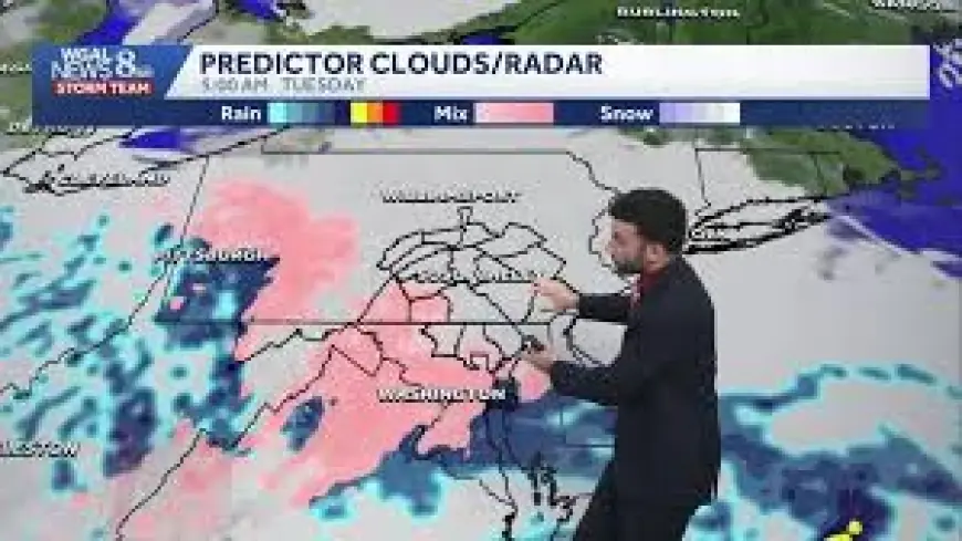
March 2, 2026 / 7: 06 AM ET — A winter weather advisory is in effect as parts of Pennsylvania brace for a multi-faceted storm that will bring snow, freezing rain, and a wintry mix. The situation matters because pockets of accumulating snow and brief ice could create slick conditions while a broader moderating temperature trend is expected later in the week.
Winter Weather Advisory: counties and timing
Advisories are in place through 10 a. m. on Tuesday morning. Specific advisories for tonight run from 10 p. m. today through 10 a. m. on Tuesday for Indiana County, the Ridges of Westmoreland and Fayette Counties, and the Laurel Highlands. High elevations and Indiana County were also highlighted for possible ice accretion, with about a tenth of an inch of ice possible in spots.
How the Pittsburgh area will be affected
Pittsburgh itself is expected to be dry for much of the day, but other parts of the region will not be so fortunate. Some people in the Pittsburgh area could see snow today, beginning what local coverage described as an active weather week for western Pennsylvania. Accumulating snow is expected for communities south of I-70, with most such places forecast to see around 2" to 3" of snow.
Where accumulations and slick spots are most likely
Snow totals will vary by terrain. Areas outside the ridges and the Laurel Highlands are likely to see smaller accumulations, often less than an inch. Temperatures are expected to remain below 32° through at least 11: 00 this morning in many areas, and snow is expected to fall through around 2: 00 this afternoon, keeping roads and surfaces vulnerable to icing in spots.
Freezing rain risk and the chance of an alert day
There remains a chance that Tuesday could be designated a First Alert Weather Day because of freezing rain. Winter weather advisories have been posted for high elevations and Indiana County for tonight, and light rain and showers are expected Tuesday morning everywhere. The key uncertainty is how low temperatures will fall overnight; most places outside the Laurel Highlands and the Ridges are expected to be right at or just above 32°, but a place or two could drop low enough for slick conditions.
Active week ahead: snow, rain, freezing rain and thunderstorms
This week is forecast to be active, with snow, rain, freezing rain, and even thunderstorms possible over the next seven days. Rain chances remain fairly high through Thursday with on-and-off precipitation and the possibility of a storm or two.
Moderating temperatures late week across south-central PA
Temperatures will rise through the week. Expect highs near the mid-50s on Wednesday, followed by warmth building into the 70s from Thursday through Saturday. There is potential for record-setting warmth late in the week, with forecast record highs listed at 74° on Friday and 76° on Saturday. That moderating temperature trend could change precipitation type quickly where it falls, turning wintry precipitation into plain rain for lower elevations.
Access issues and local site availability
Some local web access was limited: one site returned a "Site Not Available" message, and another was blocked for users coming from the European Economic Area with a notice citing GDPR enforcement and denying access. That blocked notice provided an email address and the phone number 717-291-8611 for assistance; the email address is not displayed here.
Weather conditions remain fluid through the coming days. Motorists and residents in affected counties should monitor local forecasts and expect changing conditions, especially overnight and during the transition to warmer weather later this week. Forecast details and advisory timing are subject to updates as the situation evolves.