


Wind Advisory Covers Multiple Michigan Counties as Gusts Up to 45 mph Threaten Friday
A wind advisory is in effect across portions of Michigan for Friday, with gusts forecast up to 45 mph and officials warning residents to prepare for strong winds and possible outages. Start times and covered areas vary by region, with some advisories beginning early in the morning and others later in the day.
Wind Advisory impacts and timing
The National Weather Service has issued a wind advisory for portions of southwest and south central Michigan that takes effect at 7 a. m. Friday and remains in place until 9 p. m. Southwest winds are expected to reach 15 to 30 mph with gusts up to 45 mph, and winds will ramp up through the morning with the strongest gusts likely during the afternoon hours. In Southeast Michigan, a wind advisory will be in effect from 10 a. m. to 9 p. m. for Macomb County and neighboring communities, where southwest winds of 15 to 25 mph, gusting up to 45 mph, are expected.
Who is affected and what to expect
The advisory coverage spans multiple counties. In southwest and south central Michigan, the advisory covers Ottawa, Kent, Ionia, Clinton, Allegan, Barry, Eaton, Ingham, Van Buren, Kalamazoo, Calhoun, and Jackson. Major cities in the affected area include Grand Rapids, Lansing, Kalamazoo, Battle Creek, Jackson, Holland, Grand Haven, South Haven, Hastings, Jenison, St. Johns, Charlotte, and Ionia. In Southeast Michigan, the advisory applies to Genesee, Lapeer, Lenawee, Livingston, Macomb, Monroe, Oakland, Shiawassee, Washtenaw, and Wayne counties.
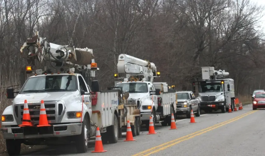
Gusty winds are expected to blow around unsecured objects and could bring down tree limbs. A few power outages may result from these conditions. Winds this strong can make driving difficult, especially for high-profile vehicles, and extra caution is advised for those on the road.
Missing pieces and regional differences
Not all details are uniform across the state: start times differ between the southwest/south central advisory window and the Southeast Michigan advisory. Localized impacts such as the precise timing of the strongest gusts, the distribution of any power outages, and the exact locations of downed limbs are not confirmed in the advisories and will vary by community.
Second-order effects and what to watch
Primary ripple effects listed in the advisories include unsecured objects being displaced, tree damage from strong gusts, and isolated power interruptions. Driving conditions could become difficult in affected counties, with the greatest risk to high-profile vehicles during the afternoon hours when gusts are expected to peak. Residents in listed communities should monitor conditions and secure loose outdoor items where possible.
Next steps: realistic scenarios and triggers
- Scenario 1 — Gusts reach 45 mph: Tree limbs are blown down and a few power outages occur; driving becomes difficult especially for high-profile vehicles.
- Scenario 2 — Gusts remain at lower end (15–25 mph): Winds cause scattered unsecured objects to move and elevated travel caution remains advisable, with fewer outages likely.
- Scenario 3 — Regional timing shift: If the strongest winds concentrate earlier or later than currently expected, peak impacts for specific communities could shift away from the documented afternoon window.
- Scenario 4 — Localized infrastructure impacts: Isolated power interruptions affect select neighborhoods; restoration timelines will depend on the extent and location of damage (not confirmed).
What to watch next: wind gust reports through the morning and afternoon, local updates for any newly posted changes to advisory timing or area coverage, and notifications about outages or fallen limbs in specific communities. Residents and drivers in the named counties should take the advisory seriously and prepare for strong winds during the specified windows on Friday.