Midlands Towns to Receive 10.7cm Snowfall: Arrival Date Announced

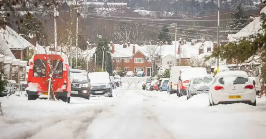
Snow is expected to cover several towns and cities in the West Midlands next week, with significant accumulation predicted. Weather forecasts suggest the snowfall will start on Tuesday, February 17, continuing into Wednesday, February 18.
Snowfall Details in the West Midlands
According to insights from WX Charts, the snow is anticipated to begin falling at 6 PM on Tuesday. It will then continue into the night, creating a total snow window of approximately 12 hours. The snowfall will vary in intensity across various locations.
Town-Specific Predictions
- Birmingham: Expected to receive 2.8 cm (1.1 in) of snow initially, with an additional 3.9 cm (1.5 in) after midnight.
- Black Country: Towns like Dudley, Walsall, West Bromwich, and Wolverhampton may see 3.9 cm (1.5 in) at 6 PM, escalating to 4.5 cm (1.7 in) by midnight.
- Craven Arms (Shropshire): Forecast indicates 6 cm (2.3 in) at 6 PM and 4.7 cm (1.8 in) later, totaling up to 10.7 cm (4.2 in) over 12 hours.
- Kidderminster (Worcestershire): Expected snowfall includes 3 cm (1.1 in) at 6 PM, followed by 3.3 cm (1.3 in) after midnight.
- Stone (Staffordshire): A forecast of 4.4 cm (1.7 in) will fall at 6 PM, increasing to 7.7 cm (3 in) by midnight.
Long-Term Weather Outlook
The Met Office has provided a broader forecast from February 16 to 25, indicating potential snowfall in northern areas alongside heavy rainfall. Atlantic low-pressure systems will influence the weather, resulting in showers and prolonged periods of rain.
While some snow is expected primarily on higher ground, heavy rainfall may impact western hills. Strong winds could occur, especially near coastal regions. Temperatures are likely to remain near normal during this period.
Stay updated with the latest weather forecasts to prepare for the anticipated snow in the West Midlands.


