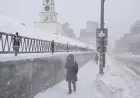


NWS Predicts Guaranteed Snow for Charlotte This Saturday
The upcoming winter storm is expected to bring significant snowfall to Charlotte, North Carolina, this weekend. The National Weather Service has issued a Winter Storm Watch from Friday at 4 PM through Sunday at 7 AM. Meteorologists predict that the city might see between two to seven inches of snow. This could potentially be one of the largest snow events in recent decades.
Potential Impacts of the Snowstorm
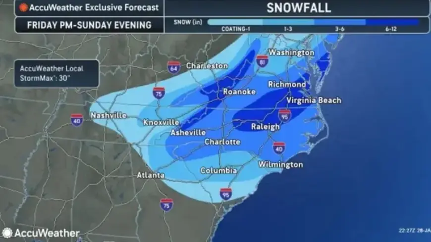
According to AccuWeather, major disruptions in travel are anticipated. Flights at major airport hubs from Charlotte to Boston may face delays. Additionally, sections of Interstate 95 could experience severe slowdowns. AccuWeather Senior Meteorologist Alex Sosnowski noted that this storm has the potential to rival historic snow events.
Historical Snowfall Comparisons
- The last benchmark snowstorm in Charlotte occurred on January 17, 2018, depositing 3.5 inches.
- A significant snow event in February 2004 recorded 13.2 inches.
- Another notable storm in January 2003 brought 8.5 inches of snow.
Forecast Details
Current predictions indicate that snow will begin to fall around midnight on Friday, with a 70% chance of precipitation. The likelihood of snow increases to 100% throughout Saturday and remains at 70% into the evening. Temperatures are expected to hover in the upper twenties, while lows could plunge to 10 degrees, with a wind chill reaching as low as minus 5.
- Estimated Total Snow Accumulation:
- 4 to 7 inches east of I-26
- 2 to 4 inches in the remaining areas
- Forecasted Wind Gusts: 25 to 35 mph
- Travel Conditions: Deteriorating rapidly by Friday evening
Travel Precautions
Roads and surfaces are likely to rapidly accumulate snow due to frigid temperatures. Gusty winds may lead to reduced visibility from blowing snow. Authorities warn that the combination of extreme cold and winds on Saturday night could pose serious health risks.
While the expected snow is described as dry and powdery—ideal for sledding but poor for snowball making—the prolonged cold weather and wind chill will create challenging conditions for residents. High temperatures on Sunday are not expected to reach freezing, even under sunny conditions, as melting snow will consume solar radiation.
This winter weather alert serves as a reminder for residents to prepare adequately for the potential impact of this significant snowstorm.