


Met Office Issues Weather Warnings: 150 Areas Face Flood Alerts
The Met Office has issued fresh weather warnings as nearly 150 areas face flood alerts across the UK. Following Storm Ingrid’s impact, heavy rain and strong winds are forecasted, raising concerns about safety and disruptions.
Current Weather Warnings and Flood Alerts
As of today, 113 flood alerts are in effect across England, indicating possible flooding, along with 20 flood warnings that predict imminent deluge. In Scotland, seven flood warnings and three alerts have been issued by the Scottish Environment Protection Agency (Sepa). Furthermore, Natural Resources Wales has two alerts active.
Forecast Details
Beginning Monday, yellow weather warnings will be in effect across southwest, southern, and mid-Wales, extending into southern England on Tuesday. Rainfall could reach up to 30mm, with higher elevations like Dartmoor and Exmoor expected to receive between 50mm and 80mm of rain.
- Rainfall Expectations:
- Up to 30mm across the region.
- Areas like Dartmoor may see 50-80mm.
- Wind Conditions:
- Peak gusts between 40-50mph inland.
- Coastal areas could experience gusts up to 60-70mph.
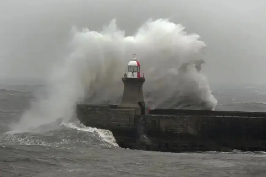
Impact of Storm Ingrid
Storm Ingrid brought significant structural damage across coastal areas. On Friday, winds reached speeds of 45-50mph, resulting in damage to the infrastructure.
In Tunstall, a decommissioned Cold War nuclear observation post fell onto the beach following severe erosion. Meanwhile, the historic Teignmouth Grand Pier in Devon partially collapsed due to heavy waves, the likes of which the National Coastwatch Institution described as unprecedented.
Expected Conditions Ahead
The weather won’t improve soon. A rain and wind warning will be in place on Tuesday, lasting from 2 AM to 10 PM. Rain will be joined by strong southeasterly winds, particularly affecting northern and eastern regions.
From midnight until midday on Tuesday, the southeast of England is also expected to face downpours, accumulating between 15-25mm of rain. Some locales could see totals rise higher, reaching 40-50mm, particularly in elevated areas.
As these weather warnings remain active, the Met Office will continue to monitor conditions as Storm Ingrid has left an indelible mark across the nation, adding urgency to preparedness measures for residents.


